
Hail Map for Montgomery, AL
The Montgomery, AL area has had 6 reports of on-the-ground hail by trained spotters, and has been under severe weather warnings 84 times during the past 12 months.
Doppler radar has detected hail at or near Montgomery, AL on 114 occasions, including 20 occasions during the past year.
| Name: | Montgomery, AL |
| Where Located: | 46.5 miles WSW of Auburn, AL |
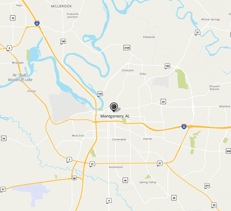
| Map: | Google Map for Montgomery, AL |
| Population: | 205764 |
| Housing Units: | 92115 |
| More Info: | Search Google for Montgomery, AL |
The Top Recent Hail Date for Montgomery, AL is Wednesday, June 14, 2023 (2nd out of 114)
Hail and Wind Damage Spotted near Montgomery, AL
| Date / Time | Report Details |
|---|---|
| 8/28/2023 1:26 PM CDT | At 126 pm cdt, a severe thunderstorm was located near hardaway, or 13 miles south of milstead, and is nearly stationary (radar indicated). Hazards include 60 mph wind gusts and quarter size hail. Hail damage to vehicles is expected. expect wind damage to roofs, siding, and trees. locations impacted include, pike road, shorter, hardaway, tysonville, waugh, cross keys, mitchell, carters hill and cecil. hail threat, radar indicated max hail size, 1. 00 in wind threat, radar indicated max wind gust, 60 mph. |
| 8/28/2023 1:12 PM CDT | At 112 pm cdt, a severe thunderstorm was located near hardaway, or 14 miles south of milstead, and is nearly stationary (radar indicated). Hazards include 60 mph wind gusts and quarter size hail. Hail damage to vehicles is expected. Expect wind damage to roofs, siding, and trees. |
| 8/28/2023 12:31 PM CDT | A tree was blown down onto powerlines… which also caused a structure fir in montgomery county AL, 4.4 miles SE of Montgomery, AL |
| 8/15/2023 2:35 PM CDT | At 235 pm cdt, a severe thunderstorm was located over waugh, or 9 miles southwest of milstead, moving east at 25 mph (radar indicated). Hazards include 60 mph wind gusts. Expect damage to roofs, siding, and trees. locations impacted include, southeastern montgomery, shorter, mount meigs, tysonville, waugh, cross keys, brassell and cecil. hail threat, radar indicated max hail size, <. 75 in wind threat, radar indicated max wind gust, 60 mph. |
| 8/15/2023 2:14 PM CDT | At 213 pm cdt, a severe thunderstorm was located over eastern montgomery, moving east at 25 mph (radar indicated). Hazards include 60 mph wind gusts and penny size hail. expect damage to roofs, siding, and trees |
| 8/11/2023 4:38 PM CDT | The severe thunderstorm warning for bullock, southwestern macon and east central montgomery counties will expire at 445 pm cdt, the storms which prompted the warning have weakened below severe limits, and no longer pose an immediate threat to life or property. therefore, the warning will be allowed to expire. however gusty winds are still possible with these thunderstorms. a severe thunderstorm watch remains in effect until 700 pm cdt for south central and southeastern alabama. |
| 8/11/2023 4:28 PM CDT | At 428 pm cdt, severe thunderstorms were located along a line extending from 6 miles west of guerryton to near franklin field to near pike road, moving southeast at 30 mph (radar indicated). Hazards include 60 mph wind gusts. Expect damage to roofs, siding, and trees. locations impacted include, union springs, midway, aberfoil, franklin field, beans crossroads, hardaway, shopton, sedgefield, high ridge, fort davis, three notch, mitchell, simsville and cecil. hail threat, radar indicated max hail size, <. 75 in wind threat, radar indicated max wind gust, 60 mph. |
| 8/11/2023 4:03 PM CDT | At 403 pm cdt, a severe thunderstorm was located near hardaway, or 8 miles south of milstead, moving southeast at 25 mph (radar indicated). Hazards include 60 mph wind gusts. expect damage to roofs, siding, and trees |
| 8/8/2023 2:19 PM CDT | At 219 pm cdt, severe thunderstorms were located along a line extending from near tysonville to 6 miles south of shopton, moving east at 40 mph (radar indicated). Hazards include 60 mph wind gusts. Expect damage to roofs, siding, and trees. locations impacted include, montgomery, meadville, pike road, pine level, auburn university in montgomery, dublin, eastdale mall, mount meigs, grady, pinedale, ramer, waugh, mitylene, carters hill, barachias, brassell, currys and cecil. hail threat, radar indicated max hail size, <. 75 in wind threat, radar indicated max wind gust, 60 mph. |
| 8/8/2023 2:11 PM CDT | At 211 pm cdt, severe thunderstorms were located along a line extending from near mount meigs to near pine level, moving east at 40 mph (radar indicated). Hazards include 60 mph wind gusts. Expect damage to roofs, siding, and trees. locations impacted include, montgomery, meadville, pike road, pine level, montgomery zoo, boylston, hyundai motors of alabama, auburn university in montgomery, dublin, woodcrest, maxwell air force base, snowdoun, grady, ramer, waugh, lagoon park, alabama state university, hope hull, eastdale mall and mount meigs. hail threat, radar indicated max hail size, <. 75 in wind threat, radar indicated max wind gust, 60 mph. |
| 8/8/2023 2:07 PM CDT | The severe thunderstorm warning for southeastern autauga, eastern lowndes and southwestern montgomery counties will expire at 215 pm cdt, the storms which prompted the warning have moved out of the area. therefore, the warning will be allowed to expire. however gusty winds are still possible with these thunderstorms. |
| 8/8/2023 1:55 PM CDT | At 155 pm cdt, severe thunderstorms were located along a line extending from near autauga county airport to highland home, moving east at 35 mph (radar indicated). Hazards include 60 mph wind gusts. Expect damage to roofs, siding, and trees. locations impacted include, southwestern montgomery, prattville, fort deposit, hayneville, white hall, lowndesboro, strata, naftel, hope hull, dannelly field, logan, sprague, grady, sellers, davenport, ramer, pintlala, calhoun, manack and letohatchee. hail threat, radar indicated max hail size, <. 75 in wind threat, radar indicated max wind gust, 60 mph. |
| 8/8/2023 1:52 PM CDT | At 151 pm cdt, severe thunderstorms were located along a line extending from montgomery to near highland home, moving east at 35 mph (radar indicated). Hazards include 60 mph wind gusts and penny size hail. expect damage to roofs, siding, and trees |
| 8/8/2023 1:49 PM CDT | Large tree limb down near the intersection of taylor road and east drive (near auburn university at montgomery). tree limb measured 8 inches in diamete in montgomery county AL, 3.1 miles WSW of Montgomery, AL |
| 8/8/2023 1:38 PM CDT | At 138 pm cdt, severe thunderstorms were located along a line extending from near white hall to near lowndes county airport, moving east at 30 mph (radar indicated). Hazards include 60 mph wind gusts. Expect damage to roofs, siding, and trees. locations impacted include, southwestern montgomery, prattville, fort deposit, mosses, hayneville, white hall, gordonville, lowndesboro, benton, beechwood, grady, sellers, davenport, ramer, pintlala, lowndes county airport, strata, naftel, hope hull and dannelly field. hail threat, radar indicated max hail size, <. 75 in wind threat, radar indicated max wind gust, 60 mph. |
| 8/8/2023 1:26 PM CDT | At 126 pm cdt, severe thunderstorms were located along a line extending from benton to near lowndes county airport, moving east at 30 mph (radar indicated). Hazards include 60 mph wind gusts. expect damage to roofs, siding, and trees |
| 8/3/2023 6:05 PM CDT | At 605 pm cdt, severe thunderstorms were located along a line extending from near notasulga to near hardaway to near snowdoun, moving southeast at 35 mph (radar indicated). Hazards include 60 mph wind gusts. Expect damage to roofs, siding, and trees. locations impacted include, tuskegee, union springs, notasulga, pike road, franklin, franklin field, lake tuskegee, shopton, tuskegee national forest, davisville, liverpool, liberty city, hardaway, society hill, warriorstand, carters hill, uphapee creek, fort davis, mitchell and cecil. hail threat, radar indicated max hail size, <. 75 in wind threat, radar indicated max wind gust, 60 mph. |
| 8/3/2023 5:51 PM CDT | At 550 pm cdt, severe thunderstorms were located along a line extending from near liberty city to near shorter to montgomery, moving southeast at 30 mph (radar indicated). Hazards include 60 mph wind gusts. Expect damage to roofs, siding, and trees. locations impacted include, montgomery, tuskegee, union springs, notasulga, meadville, milstead, pike road, coosada, shorter, franklin, hyundai motors of alabama, auburn university in montgomery, lake tuskegee, woodcrest, snowdoun, shopton, tuskegee national forest, waugh, lagoon park and hunter. hail threat, radar indicated max hail size, <. 75 in wind threat, radar indicated max wind gust, 60 mph. |
| 8/3/2023 5:37 PM CDT | At 537 pm cdt, severe thunderstorms were located along a line extending from montgomery to victoryland to near martin dam, moving east at 65 mph (radar indicated). Hazards include 60 mph wind gusts. Expect damage to roofs, siding, and trees. locations impacted include, prattville, millbrook, wetumpka, tallassee, coosada, eclectic, emerald mountain, blue ridge, southern lake martin, yates dam, ware, yates reservoir and claud. hail threat, radar indicated max hail size, <. 75 in wind threat, radar indicated max wind gust, 60 mph. |
| 8/3/2023 5:28 PM CDT | At 528 pm cdt, severe thunderstorms were located along a line extending from near martin dam to near emerald mountain to near hunter, moving southeast at 35 mph (radar indicated). Hazards include 60 mph wind gusts. expect damage to roofs, siding, and trees |
| 8/3/2023 5:17 PM CDT | At 517 pm cdt, severe thunderstorms were located along a line extending from near mulberry to millbrook to near equality, moving southeast at 30 mph (radar indicated). Hazards include 60 mph wind gusts. Expect damage to roofs, siding, and trees. locations impacted include, prattville, millbrook, wetumpka, tallassee, elmore, coosada, deatsville, eclectic, autaugaville, booth, vida junction, santuck, autauga county airport, emerald mountain, ten cedar estates, dexter, mulberry, weoka mills, jordan lake and blue ridge. hail threat, radar indicated max hail size, <. 75 in wind threat, radar indicated max wind gust, 60 mph. |
| 8/3/2023 5:02 PM CDT | At 502 pm cdt, severe thunderstorms were located along a line extending from near paul m grist state park to near deatsville to near pentonville, moving southeast at 40 mph (radar indicated). Hazards include 60 mph wind gusts. Expect damage to roofs, siding, and trees. locations impacted include, prattville, millbrook, wetumpka, tallassee, elmore, coosada, deatsville, eclectic, autaugaville, billingsley, booth, vida junction, martin dam, santuck, autauga county airport, titus, emerald mountain, welona, ten cedar estates and dexter. hail threat, radar indicated max hail size, <. 75 in wind threat, radar indicated max wind gust, 60 mph. |
| 8/3/2023 4:40 PM CDT | At 440 pm cdt, severe thunderstorms were located along a line extending from 8 miles west of parnell to 6 miles southwest of verbena to near moriah, moving southeast at 40 mph (radar indicated). Hazards include 60 mph wind gusts. expect damage to roofs, siding, and trees |
| 7/21/2023 8:13 PM CDT | At 813 pm cdt, a severe thunderstorm was located near snowdoun, or 10 miles south of montgomery, moving southeast at 25 mph (radar indicated). Hazards include 60 mph wind gusts and penny size hail. Expect damage to roofs, siding, and trees. locations impacted include, southwestern montgomery, pike road, hyundai motors of alabama, strata, hope hull, snowdoun, sprague, sellers, davenport, pinedale, pintlala, carters hill and barachias. hail threat, radar indicated max hail size, 0. 75 in wind threat, radar indicated max wind gust, 60 mph. |
| 7/21/2023 7:49 PM CDT | At 749 pm cdt, a severe thunderstorm was located over southwestern montgomery, moving southeast at 25 mph (radar indicated). Hazards include 60 mph wind gusts and penny size hail. expect damage to roofs, siding, and trees |

| 7/21/2023 7:42 PM CDT | A large tree was blown down at west blvd and birmingham hw in montgomery county AL, 9.5 miles E of Montgomery, AL |
| 7/8/2023 1:46 PM CDT | At 145 pm cdt, a severe thunderstorm was located near elmore, or near millbrook, moving east at 30 mph (radar indicated). Hazards include 60 mph wind gusts. expect damage to roofs, siding, and trees |
| 7/5/2023 5:15 PM CDT | Several small and large hardwood branches broken. maxwell afb weather observer noted a peak gust of 37 kts (43 mph in montgomery county AL, 8.4 miles ESE of Montgomery, AL |
| 7/2/2023 7:07 PM CDT | At 707 pm cdt, severe thunderstorms were located along a line extending from titus to near tallassee, moving north at 25 mph (radar indicated). Hazards include 60 mph wind gusts. Expect damage to roofs, siding, and trees. locations impacted include, prattville, millbrook, wetumpka, elmore, coosada, deatsville, eclectic, santuck, emerald mountain, jordan lake, ten cedar estates, blue ridge, dexter, bob woodruff lake, claud, holtville, wetumpka municipal airport, jordan dam, wallsboro and ware. hail threat, radar indicated max hail size, <. 75 in wind threat, radar indicated max wind gust, 60 mph. |
| 7/2/2023 6:55 PM CDT | The severe thunderstorm warning for northwestern montgomery county will expire at 700 pm cdt, the storm which prompted the warning has moved out of the area. therefore, the warning will be allowed to expire. however gusty winds are still possible with this thunderstorm. a severe thunderstorm watch remains in effect until 800 pm cdt for east central alabama. |
| 7/2/2023 6:42 PM CDT | At 642 pm cdt, severe thunderstorms were located along a line extending from near deatsville to near tysonville, moving north at 30 mph (radar indicated). Hazards include 60 mph wind gusts and penny size hail. a wind gust to 56 mph was recently measured at the montgomery airport. Expect damage to roofs, siding, and trees. locations impacted include, prattville, millbrook, wetumpka, elmore, coosada, deatsville, eclectic, santuck, emerald mountain, jordan lake, ten cedar estates, blue ridge, dexter, bob woodruff lake, claud, holtville, wetumpka municipal airport, jordan dam, wallsboro and ware. hail threat, radar indicated max hail size, 0. 75 in wind threat, radar indicated max wind gust, 60 mph. |
| 7/2/2023 6:32 PM CDT | At 632 pm cdt, a severe thunderstorm was located over northeastern montgomery, moving north at 25 mph (radar indicated). Hazards include 60 mph wind gusts. Expect damage to roofs, siding, and trees. locations impacted include, montgomery, pike road, coosada, hunter, montgomery zoo, boylston, hyundai motors of alabama, alabama state university, auburn university in montgomery, bob woodruff lake, hope hull, woodcrest, dannelly field, eastdale mall, maxwell air force base, snowdoun, montgomery riverwalk stadium, pinedale, lagoon park and gunter air force base. hail threat, radar indicated max hail size, <. 75 in wind threat, radar indicated max wind gust, 60 mph. |
| 7/2/2023 6:31 PM CDT | At 631 pm cdt, a severe thunderstorm was located over northern montgomery, moving north at 25 mph (radar indicated). Hazards include 60 mph wind gusts and penny size hail. expect damage to roofs, siding, and trees |
| 7/2/2023 6:23 PM CDT | Montgomery pd comms center reports trees down at multiple locations across the city. at least one tree onto a hous in montgomery county AL, 5.3 miles E of Montgomery, AL |
| 7/2/2023 6:14 PM CDT | At 614 pm cdt, a severe thunderstorm was located over snowdoun, or 9 miles southwest of montgomery, moving north at 20 mph (radar indicated). Hazards include 60 mph wind gusts and penny size hail. expect damage to roofs, siding, and trees |
| 6/25/2023 8:51 PM CDT | At 851 pm cdt, severe thunderstorms were located along a line extending from wetumpka to reeves airport, moving south at 25 mph (radar indicated). Hazards include 60 mph wind gusts. Expect damage to roofs, siding, and trees. locations impacted include, wetumpka, tallassee, emerald mountain, blue ridge, jordan lake, wallsboro, ware, claud, jordan dam, yates dam and yates reservoir. hail threat, radar indicated max hail size, <. 75 in wind threat, radar indicated max wind gust, 60 mph. |
| 6/25/2023 8:14 PM CDT | At 814 pm cdt, severe thunderstorms were located along a line extending from speed to near still waters resort, moving south at 25 mph (radar indicated). Hazards include 60 mph wind gusts. Expect damage to roofs, siding, and trees. locations impacted include, wetumpka, tallassee, eclectic, santuck, emerald mountain, ten cedar estates, blue ridge, kowaliga bridge, dexter, martin dam, southern lake martin, western lake martin, jordan lake, eastern lake martin, claud, central, jordan dam, wallsboro, ware and yates reservoir. hail threat, radar indicated max hail size, <. 75 in wind threat, radar indicated max wind gust, 60 mph. |
| 6/25/2023 8:02 PM CDT | At 802 pm cdt, severe thunderstorms were located along a line extending from near rockford to near still waters resort, moving south at 25 mph (radar indicated). Hazards include 60 mph wind gusts. expect damage to roofs, siding, and trees |
| 6/16/2023 9:17 PM CDT | At 917 pm cdt, severe thunderstorms were located along a line extending from benton to near davenport, moving east at 35 mph (radar indicated). Hazards include 60 mph wind gusts. expect damage to roofs, siding, and trees |
| 6/15/2023 6:18 AM CDT | At 618 am cdt, a severe thunderstorm was located near waugh, or 9 miles southwest of milstead, moving east at 55 mph (radar indicated). Hazards include 60 mph wind gusts and quarter size hail. Hail damage to vehicles is expected. Expect wind damage to roofs, siding, and trees. |
| 6/15/2023 6:18 AM CDT | At 618 am cdt, a severe thunderstorm was located near waugh, or 9 miles southwest of milstead, moving east at 55 mph (radar indicated). Hazards include 60 mph wind gusts and quarter size hail. Hail damage to vehicles is expected. Expect wind damage to roofs, siding, and trees. |
| 6/15/2023 6:13 AM CDT | The severe thunderstorm warning for southern elmore and northeastern montgomery counties will expire at 615 am cdt, the storm which prompted the warning has weakened below severe limits, and no longer poses an immediate threat to life or property. therefore, the warning will be allowed to expire. however small hail is still possible with this thunderstorm. |
| 6/15/2023 6:06 AM CDT | At 606 am cdt, a severe thunderstorm was located near tysonville, or 8 miles west of milstead, moving east at 50 mph (radar indicated). Hazards include 60 mph wind gusts and quarter size hail. Hail damage to vehicles is expected. expect wind damage to roofs, siding, and trees. locations impacted include, northeastern montgomery, wetumpka, tallassee, coosada, montgomery zoo, boylston, bob woodruff lake, emerald mountain, eastdale mall, mount meigs, blue ridge, waugh, lagoon park, gunter air force base, claud, mitylene, brassell, wallsboro, ware and tallapoosa water plant. hail threat, radar indicated max hail size, 1. 00 in wind threat, radar indicated max wind gust, 60 mph. |
| 6/15/2023 5:52 AM CDT | At 552 am cdt, a severe thunderstorm was located over emerald mountain, or near wetumpka, moving east at 55 mph (radar indicated). Hazards include 60 mph wind gusts and quarter size hail. Hail damage to vehicles is expected. expect wind damage to roofs, siding, and trees. locations impacted include, northern montgomery, prattville, millbrook, wetumpka, tallassee, elmore, coosada, montgomery zoo, boylston, bob woodruff lake, emerald mountain, waugh, lagoon park, eastdale mall, mount meigs, blue ridge, gunter air force base, auburn university in montgomery, wetumpka municipal airport and mitylene. hail threat, radar indicated max hail size, 1. 00 in wind threat, radar indicated max wind gust, 60 mph. |
| 6/15/2023 5:42 AM CDT | At 542 am cdt, a severe thunderstorm was located over bob woodruff lake, or near wetumpka, moving east at 55 mph (radar indicated). Hazards include 60 mph wind gusts and quarter size hail. Hail damage to vehicles is expected. expect wind damage to roofs, siding, and trees. locations impacted include, northern montgomery, prattville, millbrook, wetumpka, tallassee, elmore, coosada, deatsville, eclectic, montgomery zoo, boylston, bob woodruff lake, autauga county airport, emerald mountain, waugh, lagoon park, eastdale mall, mount meigs, blue ridge and gunter air force base. hail threat, radar indicated max hail size, 1. 00 in wind threat, radar indicated max wind gust, 60 mph. |
| 6/15/2023 5:32 AM CDT | At 531 am cdt, a severe thunderstorm was located over deatsville, or near millbrook, moving east at 55 mph (radar indicated). Hazards include 60 mph wind gusts and quarter size hail. Hail damage to vehicles is expected. Expect wind damage to roofs, siding, and trees. |
| 6/14/2023 5:44 PM CDT | At 544 pm cdt, severe thunderstorms were located along a line extending from 6 miles northeast of emerald mountain to near naftel, moving east at 60 mph (radar indicated). Hazards include 70 mph wind gusts. Expect considerable tree damage. damage is likely to mobile homes, roofs, and outbuildings. locations impacted include, southeastern montgomery, meadville, pike road, pine level, strata, dublin, naftel, mount meigs, sprague, grady, sellers, ramer, waugh, lapine, emerald mountain, carters hill, barachias, brassell, ware and currys. thunderstorm damage threat, considerable hail threat, radar indicated max hail size, <. 75 in wind threat, radar indicated max wind gust, 70 mph. |
| 6/14/2023 5:39 PM CDT | At 539 pm cdt, severe thunderstorms were located along a line extending from near emerald mountain to highland home, moving east at 70 mph (radar indicated). Hazards include 70 mph wind gusts. Expect considerable tree damage. damage is likely to mobile homes, roofs, and outbuildings. locations impacted include, montgomery, wetumpka, meadville, pike road, pine level, montgomery zoo, boylston, hyundai motors of alabama, auburn university in montgomery, dublin, bob woodruff lake, emerald mountain, snowdoun, grady, sellers, davenport, ramer, waugh, lagoon park and pintlala. thunderstorm damage threat, considerable hail threat, radar indicated max hail size, <. 75 in wind threat, radar indicated max wind gust, 70 mph. |
| 6/14/2023 5:23 PM CDT | At 523 pm cdt, severe thunderstorms were located along a line extending from coosada to lowndes county airport, moving east at 70 mph (radar indicated). Hazards include 60 mph wind gusts. expect damage to roofs, siding, and trees |
| 6/14/2023 5:22 PM CDT | Storm damage reported in montgomery county AL, 10.6 miles ENE of Montgomery, AL |

| 6/14/2023 4:16 PM CDT | A few trees were uprooted and several large branches dow in montgomery county AL, 9.1 miles NNE of Montgomery, AL |
| 6/14/2023 4:15 PM CDT | At 414 pm cdt, a severe thunderstorm was located near sprague, or near meadville, moving east at 55 mph. this is a destructive storm for sprague, meadville, carters hill, and pine level (radar indicated). Hazards include 90 mph wind gusts and quarter size hail. You are in a life-threatening situation. flying debris may be deadly to those caught without shelter. mobile homes will be heavily damaged or destroyed. homes and businesses will have substantial roof and window damage. expect extensive tree damage and power outages. locations impacted include, meadville, pike road, pine level, strata, dublin, naftel, snowdoun, sprague, grady, sellers, davenport, ramer, lapine, pintlala, carters hill and currys. thunderstorm damage threat, destructive hail threat, radar indicated max hail size, 1. 00 in wind threat, radar indicated max wind gust, 90 mph. |
| 6/14/2023 4:13 PM CDT | Numerous trees were blown down across central montgomery count in montgomery county AL, 11.7 miles NNE of Montgomery, AL |
| 6/14/2023 4:04 PM CDT | Trees were blown down on wasden roa in montgomery county AL, 11.8 miles ENE of Montgomery, AL |
| 6/14/2023 4:03 PM CDT | At 402 pm cdt, a severe thunderstorm was located near pintlala, or 8 miles east of hayneville, moving east at 50 mph. this is a destructive storm for pintlala, sprague, meadville, and pine level (radar indicated). Hazards include 80 mph wind gusts and quarter size hail. Flying debris will be dangerous to those caught without shelter. mobile homes will be heavily damaged. expect considerable damage to roofs, windows, and vehicles. extensive tree damage and power outages are likely. locations impacted include, southwestern montgomery, meadville, pine level, strata, dublin, naftel, hope hull, snowdoun, sprague, grady, sellers, davenport, ramer, lapine, pintlala, carters hill and currys. thunderstorm damage threat, destructive hail threat, radar indicated max hail size, 1. 00 in wind threat, radar indicated max wind gust, 80 mph. |
| 6/14/2023 3:54 PM CDT | At 354 pm cdt, a severe thunderstorm was located over hayneville, moving southeast at 50 mph (radar indicated). Hazards include 70 mph wind gusts and quarter size hail. Hail damage to vehicles is expected. expect considerable tree damage. Wind damage is also likely to mobile homes, roofs, and outbuildings. |
| 6/14/2023 3:35 PM CDT | A few trees were blown down near david driv in montgomery county AL, 4.1 miles SSW of Montgomery, AL |
| 6/14/2023 3:17 PM CDT | At 317 pm cdt, a severe thunderstorm was located near waugh, or 11 miles southwest of milstead, moving east at 40 mph (radar indicated). Hazards include 60 mph wind gusts and quarter size hail. Hail damage to vehicles is expected. expect wind damage to roofs, siding, and trees. locations impacted include, southeastern montgomery, union springs, pike road, shorter, liverpool, franklin field, guerryton, hardaway, tysonville, victoryland, davisville, waugh, mount meigs, sedgefield, barachias, fort davis, cross keys, three notch, mitchell and cecil. hail threat, radar indicated max hail size, 1. 00 in wind threat, radar indicated max wind gust, 60 mph. |
| 6/14/2023 3:06 PM CDT | Several trees were blown down around montgomer in montgomery county AL, 1.2 miles E of Montgomery, AL |
| 6/14/2023 3:05 PM CDT | At 305 pm cdt, a severe thunderstorm was located near pike road, or 9 miles east of montgomery, moving east at 45 mph (radar indicated). Hazards include 60 mph wind gusts and quarter size hail. Hail damage to vehicles is expected. expect wind damage to roofs, siding, and trees. locations impacted include, southeastern montgomery, tuskegee, tallassee, union springs, milstead, pike road, shorter, franklin, auburn university in montgomery, franklin field, guerryton, davisville, waugh, liverpool, hardaway, mount meigs, tysonville, victoryland, pinedale and warriorstand. hail threat, radar indicated max hail size, 1. 00 in wind threat, radar indicated max wind gust, 60 mph. |
| 6/14/2023 3:03 PM CDT | Quarter sized hail reported 4.2 miles ENE of Montgomery, AL, report from mping: quarter (1.00 in.). |
| 6/14/2023 2:56 PM CDT | At 255 pm cdt, a severe thunderstorm was located over eastern montgomery, moving east at 50 mph (radar indicated). Hazards include ping pong ball size hail and 60 mph wind gusts. People and animals outdoors will be injured. expect hail damage to roofs, siding, windows, and vehicles. expect wind damage to roofs, siding, and trees. locations impacted include, montgomery, tuskegee, tallassee, union springs, midway, milstead, pike road, shorter, franklin, montgomery zoo, boylston, auburn university in montgomery, franklin field, lake tuskegee, woodcrest, guerryton, emerald mountain, davisville, waugh and lagoon park. hail threat, radar indicated max hail size, 1. 50 in wind threat, radar indicated max wind gust, 60 mph. |
| 6/14/2023 2:38 PM CDT | At 238 pm cdt, a severe thunderstorm was located over boylston, or near millbrook, moving east at 40 mph (radar indicated). Hazards include 60 mph wind gusts and quarter size hail. Hail damage to vehicles is expected. Expect wind damage to roofs, siding, and trees. |
| 4/6/2023 4:59 PM CDT | At 459 pm cdt, a severe thunderstorm was located over lagoon park, or near wetumpka, moving northeast at 20 mph (radar indicated). Hazards include 60 mph wind gusts and quarter size hail. Hail damage to vehicles is expected. expect wind damage to roofs, siding, and trees. locations impacted include, northeastern montgomery, eclectic, emerald mountain, eastdale mall, blue ridge, lagoon park, ware, claud and tallapoosa water plant. hail threat, radar indicated max hail size, 1. 00 in wind threat, radar indicated max wind gust, 60 mph. |
| 4/6/2023 4:46 PM CDT | Quarter sized hail reported 3.5 miles SE of Montgomery, AL |
| 4/6/2023 4:42 PM CDT | At 442 pm cdt, a severe thunderstorm was located over northwestern montgomery, moving northeast at 25 mph (radar indicated). Hazards include 60 mph wind gusts and quarter size hail. Hail damage to vehicles is expected. Expect wind damage to roofs, siding, and trees. |
| 3/27/2023 2:39 AM CDT | At 239 am cdt, a severe thunderstorm capable of producing a tornado was located near tysonville, or 8 miles west of milstead, moving east at 35 mph (radar indicated rotation). Hazards include tornado. Flying debris will be dangerous to those caught without shelter. mobile homes will be damaged or destroyed. damage to roofs, windows, and vehicles will occur. Tree damage is likely. |
| 3/26/2023 9:59 PM CDT | At 959 pm cdt, severe thunderstorms were located along a line extending from ten cedar estates to snowdoun, moving east at 55 mph (radar indicated). Hazards include 60 mph wind gusts. Expect damage to roofs, siding, and trees. locations impacted include, montgomery, wetumpka, tallassee, pike road, eclectic, montgomery zoo, boylston, hyundai motors of alabama, santuck, auburn university in montgomery, bob woodruff lake, woodcrest, emerald mountain, snowdoun, ten cedar estates, waugh, dexter, lagoon park, pintlala and alabama state university. hail threat, radar indicated max hail size, <. 75 in wind threat, radar indicated max wind gust, 60 mph. |
| 3/26/2023 9:53 PM CDT | At 953 pm cdt, severe thunderstorms were located along a line extending from jordan lake to near pintlala, moving east at 55 mph (radar indicated). Hazards include 60 mph wind gusts. Expect damage to roofs, siding, and trees. locations impacted include, montgomery, prattville, millbrook, wetumpka, tallassee, meadville, pike road, elmore, coosada, deatsville, eclectic, hyundai motors of alabama, santuck, auburn university in montgomery, woodcrest, snowdoun, sellers, ten cedar estates, waugh and dexter. hail threat, radar indicated max hail size, <. 75 in wind threat, radar indicated max wind gust, 60 mph. |
| 3/26/2023 9:36 PM CDT | At 935 pm cdt, severe thunderstorms were located along a line extending from near vida junction to beechwood, moving east at 55 mph (radar indicated). Hazards include 60 mph wind gusts. expect damage to roofs, siding, and trees |
| 3/26/2023 5:33 PM CDT | At 533 pm cdt, a severe thunderstorm was located over waugh, or 11 miles southwest of milstead, moving northeast at 30 mph (radar indicated). Hazards include tennis ball size hail and 60 mph wind gusts. People and animals outdoors will be injured. expect hail damage to roofs, siding, windows, and vehicles. expect wind damage to roofs, siding, and trees. locations impacted include, eastern montgomery, tuskegee, tallassee, milstead, shorter, franklin, mount meigs, tysonville, victoryland, waugh, uphapee creek, cross keys, brassell, cecil, moton field municipal airport, yates dam and yates reservoir. thunderstorm damage threat, considerable hail threat, radar indicated max hail size, 2. 50 in wind threat, radar indicated max wind gust, 60 mph. |
| 3/26/2023 5:28 PM CDT | At 528 pm cdt, a severe thunderstorm was located over mount meigs, or 10 miles east of montgomery, moving northeast at 30 mph (radar indicated). Hazards include 60 mph wind gusts and half dollar size hail. Hail damage to vehicles is expected. Expect wind damage to roofs, siding, and trees. |
| 1/12/2023 2:50 PM CST | At 250 pm cst, severe thunderstorms were located along a line extending from pike road to near ramer, moving east at 55 mph (radar indicated). Hazards include 60 mph wind gusts and quarter size hail. Hail damage to vehicles is expected. expect wind damage to roofs, siding, and trees. locations impacted include, southeastern montgomery, meadville, pike road, pine level, strata, dublin, naftel, sprague, grady, sellers, ramer, lapine, carters hill, currys and cecil. hail threat, radar indicated max hail size, 1. 00 in wind threat, radar indicated max wind gust, 60 mph. |
| 1/12/2023 2:44 PM CST | At 244 pm cst, severe thunderstorms were located along a line extending from near notasulga to milstead to montgomery, moving southeast at 10 mph (radar indicated). Hazards include 60 mph wind gusts. Expect damage to roofs, siding, and trees. locations impacted include, eastern montgomery, tuskegee, tallassee, notasulga, milstead, shorter, franklin, auburn university in montgomery, liberty city, reeves airport, tallapoosa city, emerald mountain, mount meigs, tysonville, victoryland, waugh, mitylene, uphapee creek, barachias and brassell. hail threat, radar indicated max hail size, <. 75 in wind threat, radar indicated max wind gust, 60 mph. |
| 1/12/2023 2:39 PM CST | At 239 pm cst, severe thunderstorms were located along a line extending from pike road to near davenport, moving east at 65 mph (radar indicated). Hazards include 60 mph wind gusts and quarter size hail. Hail damage to vehicles is expected. expect wind damage to roofs, siding, and trees. locations impacted include, southeastern montgomery, fort deposit, meadville, pike road, pine level, strata, dublin, naftel, snowdoun, logan, sprague, grady, sellers, davenport, ramer, lapine, pintlala, carters hill, barachias and currys. hail threat, radar indicated max hail size, 1. 00 in wind threat, radar indicated max wind gust, 60 mph. |

| 1/12/2023 2:34 PM CST | At 234 pm cst, severe thunderstorms were located along a line extending from near oak bowery to near opelika to near notasulga, moving east at 80 mph (radar indicated). Hazards include 70 mph wind gusts. Expect considerable tree damage. damage is likely to mobile homes, roofs, and outbuildings. locations impacted include, eastern montgomery, tuskegee, tallassee, notasulga, milstead, shorter, franklin, auburn university in montgomery, reeves airport, emerald mountain, waugh, liberty city, tallapoosa city, mount meigs, tysonville, victoryland, blue ridge, mitylene, uphapee creek and brassell. thunderstorm damage threat, considerable hail threat, radar indicated max hail size, <. 75 in wind threat, radar indicated max wind gust, 70 mph. |
| 1/12/2023 2:25 PM CST | At 225 pm cst, severe thunderstorms were located along a line extending from near hope hull to 6 miles west of lowndes county airport, moving east at 65 mph (radar indicated). Hazards include 60 mph wind gusts and quarter size hail. Hail damage to vehicles is expected. Expect wind damage to roofs, siding, and trees. |
| 1/12/2023 2:18 PM CST | At 217 pm cst, severe thunderstorms were located along a line extending from montgomery to 10 miles northeast of pine apple, moving east at 50 mph (radar indicated). Hazards include 60 mph wind gusts and quarter size hail. Hail damage to vehicles is expected. expect wind damage to roofs, siding, and trees. locations impacted include, montgomery, fort deposit, mosses, hayneville, coosada, gordonville, lowndesboro, montgomery zoo, boylston, hyundai motors of alabama, beechwood, auburn university in montgomery, woodcrest, maxwell air force base, snowdoun, davenport, lagoon park, pintlala, hunter and lowndes county airport. hail threat, radar indicated max hail size, 1. 00 in wind threat, radar indicated max wind gust, 60 mph. |
| 1/12/2023 2:06 PM CST | Asos report of 62 mph gust at dannelly fiel in montgomery county AL, 10.6 miles ENE of Montgomery, AL |
| 1/12/2023 2:03 PM CST | Damage reported along hunter lane and camellia driv in montgomery county AL, 2.3 miles SSE of Montgomery, AL |
| 1/12/2023 2:03 PM CST | At 202 pm cst, severe thunderstorms were located along a line extending from near eclectic to near emerald mountain to montgomery, moving east at 70 mph (radar indicated). Hazards include 70 mph wind gusts and penny size hail. Expect considerable tree damage. Damage is likely to mobile homes, roofs, and outbuildings. |
| 1/12/2023 2:01 PM CST | Minor tree damage reporte in montgomery county AL, 3.1 miles SE of Montgomery, AL |
| 1/12/2023 1:56 PM CST | At 156 pm cst, severe thunderstorms were located along a line extending from near coosada to near pine apple, moving east at 60 mph (radar indicated). Hazards include 60 mph wind gusts and quarter size hail. Hail damage to vehicles is expected. expect wind damage to roofs, siding, and trees. locations impacted include, montgomery, fort deposit, mosses, hayneville, coosada, white hall, gordonville, lowndesboro, montgomery zoo, boylston, hyundai motors of alabama, beechwood, auburn university in montgomery, bob woodruff lake, woodcrest, maxwell air force base, snowdoun, davenport, lagoon park and pintlala. hail threat, radar indicated max hail size, 1. 00 in wind threat, radar indicated max wind gust, 60 mph. |
| 1/12/2023 1:46 PM CST | At 146 pm cst, severe thunderstorms were located along a line extending from near wedowee to near camp hill to near emerald mountain, moving east at 85 mph (radar indicated). Hazards include 70 mph wind gusts and penny size hail. Expect considerable tree damage. damage is likely to mobile homes, roofs, and outbuildings. locations impacted include, prattville, millbrook, wetumpka, tallassee, elmore, coosada, deatsville, eclectic, autaugaville, booth, martin dam, santuck, autauga county airport, emerald mountain, ten cedar estates, dexter, jordan lake, blue ridge, kowaliga bridge and southern lake martin. thunderstorm damage threat, considerable hail threat, radar indicated max hail size, 0. 75 in wind threat, radar indicated max wind gust, 70 mph. |
| 1/12/2023 1:40 PM CST | At 140 pm cst, severe thunderstorms were located along a line extending from near autauga county airport to near vredenburgh, moving east at 60 mph (radar indicated). Hazards include 60 mph wind gusts and quarter size hail. Hail damage to vehicles is expected. expect wind damage to roofs, siding, and trees. locations impacted include, montgomery, fort deposit, mosses, hayneville, coosada, white hall, gordonville, lowndesboro, benton, montgomery zoo, boylston, hyundai motors of alabama, beechwood, auburn university in montgomery, bob woodruff lake, woodcrest, maxwell air force base, snowdoun, davenport and lagoon park. hail threat, radar indicated max hail size, 1. 00 in wind threat, radar indicated max wind gust, 60 mph. |
| 1/12/2023 1:35 PM CST | At 134 pm cst, severe thunderstorms were located along a line extending from 6 miles southeast of lineville to southern lake martin to near boylston, moving east at 85 mph (radar indicated). Hazards include 70 mph wind gusts and penny size hail. Expect considerable tree damage. damage is likely to mobile homes, roofs, and outbuildings. locations impacted include, prattville, millbrook, wetumpka, tallassee, goodwater, kellyton, equality, elmore, coosada, deatsville, eclectic, autaugaville, booth, martin dam, bradford, santuck, cottage grove, autauga county airport, titus and emerald mountain. thunderstorm damage threat, considerable hail threat, radar indicated max hail size, 0. 75 in wind threat, radar indicated max wind gust, 70 mph. |
| 1/12/2023 1:24 PM CST | At 124 pm cst, severe thunderstorms were located along a line extending from near benton to near yellow bluff, moving east at 60 mph (radar indicated). Hazards include 60 mph wind gusts and quarter size hail. Hail damage to vehicles is expected. Expect wind damage to roofs, siding, and trees. |
| 1/12/2023 1:09 PM CST | At 109 pm cst, severe thunderstorms were located along a line extending from stewartville to near deatsville to near benton, moving east at 85 mph (radar indicated). Hazards include 70 mph wind gusts and penny size hail. Expect considerable tree damage. Damage is likely to mobile homes, roofs, and outbuildings. |
| 1/4/2023 3:13 AM CST | Damage to field at buddy watson park. possible tornad in montgomery county AL, 2.9 miles W of Montgomery, AL |
| 1/4/2023 3:13 AM CST | Corrects previous tstm wnd dmg report from 1 s auburn univ montgomery. roof off home near gloucester mews. possible tornad in montgomery county AL, 2.3 miles W of Montgomery, AL |
| 1/4/2023 3:13 AM CST | Trees down along bell road near eastwood glen. possible tornad in montgomery county AL, 1.7 miles W of Montgomery, AL |
| 1/4/2023 3:13 AM CST | Tree on house on heritage oak court. possible tornad in montgomery county AL, 2.5 miles WNW of Montgomery, AL |
| 1/4/2023 3:11 AM CST | Trees down in green acres subdivisio in montgomery county AL, 1.5 miles NE of Montgomery, AL |
| 1/4/2023 2:55 AM CST | At 255 am cst, severe thunderstorms were located along a line extending from near nixburg to santuck to montgomery to snowdoun, moving east at 50 mph (radar indicated). Hazards include 60 mph wind gusts and penny size hail. Expect damage to roofs, siding, and trees. locations impacted include, northern montgomery, wetumpka, tallassee, equality, eclectic, montgomery zoo, boylston, santuck, cottage grove, bob woodruff lake, emerald mountain, nixburg, dexter, lagoon park, highway 9 and highway 22, montgomery riverwalk stadium, blue ridge, kowaliga bridge, gunter air force base and alabama state capitol. hail threat, radar indicated max hail size, 0. 75 in wind threat, radar indicated max wind gust, 60 mph. |
| 1/4/2023 2:44 AM CST | At 243 am cst, severe thunderstorms were located along a line extending from speed to near elmore to near hunter to near pintlala, moving east at 50 mph (radar indicated). Hazards include 60 mph wind gusts and penny size hail. Expect damage to roofs, siding, and trees. locations impacted include, montgomery, prattville, millbrook, wetumpka, tallassee, equality, pike road, elmore, coosada, deatsville, eclectic, hyundai motors of alabama, santuck, auburn university in montgomery, titus, woodcrest, snowdoun, ten cedar estates, waugh and dexter. hail threat, radar indicated max hail size, 0. 75 in wind threat, radar indicated max wind gust, 60 mph. |
| 1/4/2023 2:31 AM CST | At 231 am cst, severe thunderstorms were located along a line extending from near welona to near deatsville to near lowndesboro to hayneville, moving east at 50 mph (radar indicated). Hazards include 60 mph wind gusts and penny size hail. expect damage to roofs, siding, and trees |
| 1/3/2023 4:54 PM CST | At 453 pm cst, a severe thunderstorm was located near pike road, or 13 miles southeast of montgomery, moving northeast at 55 mph (radar indicated). Hazards include 60 mph wind gusts and nickel size hail. expect damage to roofs, siding, and trees |
| 1/3/2023 2:55 PM CST | At 255 pm cst, a severe thunderstorm was located over emerald mountain, or 9 miles southeast of wetumpka, moving northeast at 45 mph (radar indicated). Hazards include 60 mph wind gusts and quarter size hail. Hail damage to vehicles is expected. expect wind damage to roofs, siding, and trees. locations impacted include, northeastern montgomery, tallassee, eclectic, emerald mountain, auburn university in montgomery, blue ridge, ware, claud, mitylene, tallapoosa water plant, yates reservoir and yates dam. hail threat, radar indicated max hail size, 1. 00 in wind threat, radar indicated max wind gust, 60 mph. |
| 1/3/2023 2:44 PM CST | At 243 pm cst, a severe thunderstorm was located over northeastern montgomery, moving northeast at 60 mph (radar indicated). Hazards include 60 mph wind gusts and half dollar size hail. Hail damage to vehicles is expected. expect wind damage to roofs, siding, and trees. Locations impacted include, montgomery, wetumpka, tallassee, eclectic, montgomery zoo, boylston, hyundai motors of alabama, auburn university in montgomery, bob woodruff lake, woodcrest, emerald mountain, maxwell air force base, lagoon park, hunter, alabama state university, hope hull, eastdale mall, montgomery riverwalk stadium, blue ridge and gunter air force base. |
| 1/3/2023 2:42 PM CST | Quarter sized hail reported 2.7 miles ESE of Montgomery, AL, dime to quarter size hail reported in waka parking lot. |

| 1/3/2023 2:38 PM CST | At 238 pm cst, a severe thunderstorm was located near dannelly field, or 10 miles northeast of hayneville, moving northeast at 45 mph (radar indicated). Hazards include 60 mph wind gusts and quarter size hail. Hail damage to vehicles is expected. Expect wind damage to roofs, siding, and trees. |
| 11/30/2022 3:24 AM CST | At 324 am cst, a confirmed tornado was located over blue ridge, or near wetumpka, moving east at 45 mph (radar confirmed tornado). Hazards include damaging tornado and quarter size hail. Flying debris will be dangerous to those caught without shelter. mobile homes will be damaged or destroyed. damage to roofs, windows, and vehicles will occur. tree damage is likely. Locations impacted include, northern montgomery, wetumpka, tallassee, elmore, coosada, eclectic, boylston, santuck, bob woodruff lake, emerald mountain, blue ridge, martin dam, southern lake martin, claud, wallsboro, ware, tallapoosa water plant, yates reservoir and yates dam. |
| 11/30/2022 3:19 AM CST | At 319 am cst, a confirmed tornado was located over bob woodruff lake, or near wetumpka, moving east at 40 mph (radar confirmed tornado). Hazards include damaging tornado and quarter size hail. Flying debris will be dangerous to those caught without shelter. mobile homes will be damaged or destroyed. damage to roofs, windows, and vehicles will occur. tree damage is likely. Locations impacted include, northern montgomery, wetumpka, tallassee, elmore, coosada, eclectic, boylston, santuck, bob woodruff lake, emerald mountain, blue ridge, martin dam, southern lake martin, claud, wallsboro, ware, tallapoosa water plant, yates reservoir and yates dam. |
| 11/30/2022 3:07 AM CST | At 307 am cst, a severe thunderstorm capable of producing a tornado was located over millbrook, moving east at 45 mph (radar indicated rotation). Hazards include tornado and baseball size hail. Flying debris will be dangerous to those caught without shelter. mobile homes will be damaged or destroyed. damage to roofs, windows, and vehicles will occur. tree damage is likely. Locations impacted include, northwestern montgomery, prattville, millbrook, wetumpka, tallassee, elmore, coosada, deatsville, eclectic, montgomery zoo, boylston, santuck, bob woodruff lake, emerald mountain, blue ridge, martin dam, southern lake martin, wetumpka municipal airport, wallsboro and yates reservoir. |
| 11/30/2022 3:01 AM CST | At 300 am cst, a severe thunderstorm capable of producing a tornado was located over autauga county airport, or over prattville, moving east at 45 mph (radar indicated rotation). Hazards include tornado and quarter size hail. Flying debris will be dangerous to those caught without shelter. mobile homes will be damaged or destroyed. damage to roofs, windows, and vehicles will occur. Tree damage is likely. |
| 10/12/2022 2:49 PM CDT | At 249 pm cdt, a severe thunderstorm was located 7 miles southeast of waugh, or 12 miles southwest of milstead, moving east at 45 mph (radar indicated). Hazards include 60 mph wind gusts and quarter size hail. Hail damage to vehicles is expected. Expect wind damage to roofs, siding, and trees. |
| 10/12/2022 2:28 PM CDT | Trees down blocking us-31 at pintlal in montgomery county AL, 14.8 miles NE of Montgomery, AL |
| 8/7/2022 7:50 PM CDT | At 750 pm cdt, a severe thunderstorm was located over emerald mountain, or 7 miles southeast of wetumpka, moving southwest at 15 mph (radar indicated). Hazards include 60 mph wind gusts and penny size hail. expect damage to roofs, siding, and trees |
| 8/1/2022 3:55 PM CDT | The severe thunderstorm warning for north central montgomery county will expire at 400 pm cdt, the storm which prompted the warning has weakened below severe limits, and no longer poses an immediate threat to life or property. therefore, the warning will be allowed to expire. however gusty winds are still possible with this thunderstorm. |
| 8/1/2022 3:50 PM CDT | At 350 pm cdt, a severe thunderstorm was located over northeastern montgomery, and is nearly stationary (radar indicated). Hazards include 60 mph wind gusts. Expect damage to roofs, siding, and trees. locations impacted include, eastern montgomery, auburn university in montgomery, eastdale mall, lagoon park, gunter air force base and mitylene. hail threat, radar indicated max hail size, <. 75 in wind threat, radar indicated max wind gust, 60 mph. |
| 8/1/2022 3:39 PM CDT | At 339 pm cdt, a severe thunderstorm was located over eastern montgomery, and is nearly stationary (radar indicated). Hazards include 60 mph wind gusts and quarter size hail. Hail damage to vehicles is expected. expect wind damage to roofs, siding, and trees. locations impacted include, montgomery, eastdale mall, montgomery zoo, alabama state university, auburn university in montgomery, montgomery riverwalk stadium, lagoon park, gunter air force base, alabama state capitol and mitylene. hail threat, radar indicated max hail size, 1. 00 in wind threat, radar indicated max wind gust, 60 mph. |
| 8/1/2022 3:38 PM CDT | Trees down (mping report in montgomery county AL, 2.7 miles ESE of Montgomery, AL |
| 8/1/2022 3:38 PM CDT | Large pine tree uprooted on hill hedge driv in montgomery county AL, 3 miles E of Montgomery, AL |
| 7/21/2022 8:19 PM CDT | At 819 pm cdt, severe thunderstorms were located along a line extending from near snowdoun to near hayneville to 6 miles south of tyler, moving south at 40 mph (radar indicated). Hazards include 60 mph wind gusts and quarter size hail. Hail damage to vehicles is expected. expect wind damage to roofs, siding, and trees. locations impacted include, montgomery, fort deposit, mosses, hayneville, white hall, gordonville, lowndesboro, benton, montgomery zoo, boylston, hyundai motors of alabama, beechwood, woodcrest, maxwell air force base, snowdoun, sellers, davenport, pintlala, lowndes county airport and alabama state university. hail threat, radar indicated max hail size, 1. 00 in wind threat, radar indicated max wind gust, 60 mph. |
| 7/21/2022 8:18 PM CDT | Storm damage reported in montgomery county AL, 10.6 miles ENE of Montgomery, AL |
| 7/21/2022 8:04 PM CDT | At 804 pm cdt, severe thunderstorms were located along a line extending from waugh to near dannelly field to near selmont-west selmont, moving south at 25 mph (radar indicated). Hazards include 60 mph wind gusts and quarter size hail. Hail damage to vehicles is expected. expect wind damage to roofs, siding, and trees. locations impacted include, montgomery, fort deposit, mosses, hayneville, meadville, pike road, coosada, white hall, gordonville, lowndesboro, benton, hyundai motors of alabama, auburn university in montgomery, dublin, woodcrest, snowdoun, sellers, ramer, waugh and lagoon park. hail threat, radar indicated max hail size, 1. 00 in wind threat, radar indicated max wind gust, 60 mph. |
| 7/21/2022 7:43 PM CDT | At 743 pm cdt, severe thunderstorms were located along a line extending from tallassee to montgomery to valley grande, moving south at 35 mph (radar indicated). Hazards include 60 mph wind gusts and quarter size hail. Hail damage to vehicles is expected. expect wind damage to roofs, siding, and trees. locations impacted include, montgomery, union springs, fort deposit, mosses, hayneville, meadville, milstead, pike road, coosada, white hall, shorter, gordonville, franklin, lowndesboro, benton, hyundai motors of alabama, auburn university in montgomery, dublin, woodcrest and snowdoun. hail threat, radar indicated max hail size, 1. 00 in wind threat, radar indicated max wind gust, 60 mph. |
| 7/21/2022 7:39 PM CDT | At 739 pm cdt, severe thunderstorms were located along a line extending from near still waters resort to emerald mountain to near paul m grist state park to central mills, moving south at 20 mph (radar indicated). Hazards include 60 mph wind gusts and penny size hail. Expect damage to roofs, siding, and trees. locations impacted include, prattville, selma, millbrook, wetumpka, tallassee, valley grande, selmont-west selmont, elmore, coosada, deatsville, eclectic, autaugaville, orrville, billingsley, martin dam, bogue chitto, santuck, tyler, autauga county airport and dannelly reservoir. hail threat, radar indicated max hail size, 0. 75 in wind threat, radar indicated max wind gust, 60 mph. |
| 7/21/2022 7:34 PM CDT | At 733 pm cdt, severe thunderstorms were located along a line extending from near still waters resort to near blue ridge to valley grande to near uniontown, moving south at 45 mph (radar indicated). Hazards include 60 mph wind gusts and penny size hail. Expect damage to roofs, siding, and trees. locations impacted include, prattville, selma, millbrook, wetumpka, tallassee, valley grande, selmont-west selmont, elmore, coosada, deatsville, eclectic, autaugaville, orrville, billingsley, martin dam, bogue chitto, santuck, vaiden, tyler and autauga county airport. hail threat, radar indicated max hail size, 0. 75 in wind threat, radar indicated max wind gust, 60 mph. |
| 7/21/2022 7:24 PM CDT | At 724 pm cdt, severe thunderstorms were located along a line extending from martin dam to near millbrook to near paul m grist state park, moving south at 35 mph (radar indicated). Hazards include 60 mph wind gusts and quarter size hail. Hail damage to vehicles is expected. Expect wind damage to roofs, siding, and trees. |
| 7/21/2022 7:07 PM CDT | At 707 pm cdt, severe thunderstorms were located along a line extending from hillabee creek to speed to 6 miles south of talladega national forest to near uniontown, moving south at 30 mph (radar indicated). Hazards include 60 mph wind gusts and penny size hail. Expect damage to roofs, siding, and trees. locations impacted include, prattville, selma, alexander city, millbrook, wetumpka, tallassee, valley grande, selmont-west selmont, elmore, coosada, deatsville, eclectic, autaugaville, jacksons` gap, orrville, billingsley, martin dam, bogue chitto, santuck and vaiden. hail threat, radar indicated max hail size, 0. 75 in wind threat, radar indicated max wind gust, 60 mph. |
| 7/21/2022 6:53 PM CDT | At 652 pm cdt, severe thunderstorms were located along a line extending from 8 miles west of goldville to near pentonville to near talladega national forest to near newbern, moving south at 45 mph (radar indicated). Hazards include 60 mph wind gusts and penny size hail. expect damage to roofs, siding, and trees |
| 7/21/2022 6:52 PM CDT | At 652 pm cdt, severe thunderstorms were located along a line extending from 8 miles west of goldville to near pentonville to near talladega national forest to near newbern, moving south at 45 mph (radar indicated). Hazards include 60 mph wind gusts and penny size hail. expect damage to roofs, siding, and trees |
| 6/17/2022 6:25 PM CDT | At 625 pm cdt, a severe thunderstorm was located near deatsville, or 9 miles northwest of millbrook, moving southeast at 20 mph (radar indicated). Hazards include 60 mph wind gusts and quarter size hail. Hail damage to vehicles is expected. Expect wind damage to roofs, siding, and trees. |
| 6/15/2022 9:48 PM CDT | At 947 pm cdt, severe thunderstorms were located along a line extending from near marbury to 6 miles northeast of lowndesboro to near kent, moving west at 35 mph (radar indicated). Hazards include 60 mph wind gusts. wind gusts to 51 mph have been measured with this line of storms with reports of downed trees. Expect damage to roofs, siding, and trees. locations impacted include, southwestern montgomery, prattville, troy, millbrook, fort deposit, mosses, hayneville, deatsville, autaugaville, white hall, gordonville, billingsley, lowndesboro, booth, vida junction, beechwood, dublin, autauga county airport, woodcrest and maxwell air force base. hail threat, radar indicated max hail size, <. 75 in wind threat, radar indicated max wind gust, 60 mph. |
| 6/15/2022 9:19 PM CDT | At 918 pm cdt, severe thunderstorms were located along a line extending from near speed to pike road to near linwood, moving west at 25 mph (emergency management). Hazards include 60 mph wind gusts. trees have been knoced down with this line of storms. expect damage to roofs, siding, and trees |
| 5/22/2022 1:06 PM CDT | At 105 pm cdt, a severe thunderstorm was located near davisville, or 7 miles north of union springs, moving north at 35 mph (radar indicated). Hazards include 60 mph wind gusts and nickel size hail. Expect damage to roofs, siding, and trees. locations impacted include, tuskegee, union springs, midway, shorter, aberfoil, franklin field, lake tuskegee, guerryton, shopton, davisville, waugh, liverpool, hardaway, tysonville, victoryland, warriorstand, fort davis, brassell, three notch and mitchell. hail threat, radar indicated max hail size, 0. 88 in wind threat, radar indicated max wind gust, 60 mph. |
| 5/22/2022 12:51 PM CDT | At 1250 pm cdt, a severe thunderstorm was located over union springs, moving north at 35 mph (radar indicated). Hazards include 60 mph wind gusts and nickel size hail. Expect damage to roofs, siding, and trees. locations impacted include, tuskegee, union springs, midway, shorter, pine level, aberfoil, franklin field, lake tuskegee, beans crossroads, guerryton, shopton, davisville, waugh, liverpool, hardaway, tysonville, victoryland, warriorstand, high ridge and fort davis. hail threat, radar indicated max hail size, 0. 88 in wind threat, radar indicated max wind gust, 60 mph. |
| 5/22/2022 12:37 PM CDT | At 1236 pm cdt, a severe thunderstorm was located near beans crossroads, or 11 miles south of union springs, moving north at 35 mph (radar indicated). Hazards include 60 mph wind gusts and nickel size hail. expect damage to roofs, siding, and trees |
| 5/1/2022 12:50 PM CDT | At 1250 pm cdt, a severe thunderstorm was located near pintlala, or near hayneville, moving east at 10 mph (radar indicated). Hazards include 60 mph wind gusts and quarter size hail. Hail damage to vehicles is expected. expect wind damage to roofs, siding, and trees. locations impacted include, davenport, snowdoun, sprague, pintlala, sellers and letohatchee. hail threat, radar indicated max hail size, 1. 00 in wind threat, radar indicated max wind gust, 60 mph. |
| 5/1/2022 12:34 PM CDT | At 1234 pm cdt, a severe thunderstorm was located near hayneville, moving east at 10 mph (radar indicated). Hazards include 60 mph wind gusts and quarter size hail. Hail damage to vehicles is expected. Expect wind damage to roofs, siding, and trees. |
| 4/5/2022 11:21 AM CDT | At 1120 am cdt, severe thunderstorms were located along a line extending from near waugh to 8 miles southeast of glenwood, moving east at 60 mph (radar indicated). Hazards include 60 mph wind gusts and penny size hail. expect damage to roofs, siding, and trees |
| 4/5/2022 10:51 AM CDT | The tornado warning for west central bullock and southeastern montgomery counties will expire at 1100 am cdt, the storm which prompted the warning has weakened below severe limits, and no longer appears capable of producing a tornado. therefore, the warning will be allowed to expire. a tornado watch remains in effect until 200 pm cdt for south central and southeastern alabama. |
| 4/5/2022 10:42 AM CDT | At 1041 am cdt, a severe thunderstorm capable of producing a tornado was located near meadville, moving northeast at 50 mph (radar indicated rotation). Hazards include tornado. Flying debris will be dangerous to those caught without shelter. mobile homes will be damaged or destroyed. damage to roofs, windows, and vehicles will occur. tree damage is likely. Locations impacted include, meadville, pike road, pine level, sprague, shopton, dublin, ramer, carters hill and cecil. |
| 4/5/2022 10:29 AM CDT | At 1028 am cdt, a severe thunderstorm capable of producing a tornado was located over sellers, or 11 miles west of meadville, moving northeast at 50 mph (radar indicated rotation). Hazards include tornado. Flying debris will be dangerous to those caught without shelter. mobile homes will be damaged or destroyed. damage to roofs, windows, and vehicles will occur. tree damage is likely. Locations impacted include, meadville, pike road, pine level, strata, dublin, naftel, sprague, shopton, grady, sellers, davenport, ramer, lapine, carters hill, currys and cecil. |
| 4/5/2022 10:10 AM CDT | At 1010 am cdt, a severe thunderstorm capable of producing a tornado was located near lowndes county airport, or near fort deposit, moving northeast at 50 mph (radar indicated rotation). Hazards include tornado. Flying debris will be dangerous to those caught without shelter. mobile homes will be damaged or destroyed. damage to roofs, windows, and vehicles will occur. Tree damage is likely. |
| 4/5/2022 8:21 AM CDT | The severe thunderstorm warning for northern montgomery county will expire at 830 am cdt, the storm which prompted the warning has weakened below severe limits, and is exiting the warned area. therefore, the warning will be allowed to expire. however small hail and heavy rain are still possible with this thunderstorm as it exits the county. a tornado watch remains in effect until 200 pm cdt for south central, southeastern and east central alabama. |
| 4/5/2022 8:08 AM CDT | At 808 am cdt, a severe thunderstorm was located over southeastern montgomery, moving northeast at 45 mph (radar indicated). Hazards include 60 mph wind gusts and quarter size hail. Hail damage to vehicles is expected. expect wind damage to roofs, siding, and trees. locations impacted include, montgomery, pike road, montgomery zoo, boylston, alabama state university, auburn university in montgomery, mount meigs, eastdale mall, maxwell air force base, montgomery riverwalk stadium, pinedale, waugh, lagoon park, gunter air force base, alabama state capitol, mitylene, barachias, brassell, tallapoosa water plant and cecil. hail threat, radar indicated max hail size, 1. 00 in wind threat, radar indicated max wind gust, 60 mph. |
| 4/5/2022 7:59 AM CDT | At 758 am cdt, a severe thunderstorm was located over snowdoun, or near montgomery, moving northeast at 45 mph (radar indicated). Hazards include 60 mph wind gusts and quarter size hail. Hail damage to vehicles is expected. expect wind damage to roofs, siding, and trees. locations impacted include, montgomery, pike road, montgomery zoo, boylston, hyundai motors of alabama, alabama state university, auburn university in montgomery, hope hull, woodcrest, dannelly field, mount meigs, eastdale mall, snowdoun, montgomery riverwalk stadium, pinedale, waugh, lagoon park, gunter air force base, alabama state capitol and mitylene. hail threat, radar indicated max hail size, 1. 00 in wind threat, radar indicated max wind gust, 60 mph. |
| 4/5/2022 7:51 AM CDT | Quarter sized hail reported 15.8 miles NE of Montgomery, AL |
| 4/5/2022 7:51 AM CDT | At 751 am cdt, a severe thunderstorm was located over pintlala, or 11 miles east of hayneville, moving northeast at 40 mph (radar indicated). Hazards include 60 mph wind gusts and quarter size hail. Hail damage to vehicles is expected. Expect wind damage to roofs, siding, and trees. |
| 4/5/2022 7:25 AM CDT | At 725 am cdt, a severe thunderstorm was located over blue ridge, or near wetumpka, moving northeast at 50 mph (radar indicated). Hazards include 60 mph wind gusts and quarter size hail. Hail damage to vehicles is expected. Expect wind damage to roofs, siding, and trees. |
| 3/31/2022 12:48 AM CDT | At 1248 am cdt, a severe squall line capable of producing both tornadoes and extensive straight line wind damage was located along a line extending from near deatsville to near wetumpka to montgomery, moving northeast at 50 mph (radar indicated rotation). Hazards include tornado. Flying debris will be dangerous to those caught without shelter. mobile homes will be damaged or destroyed. damage to roofs, windows, and vehicles will occur. tree damage is likely. Locations impacted include, northern montgomery, millbrook, wetumpka, elmore, coosada, deatsville, eclectic, santuck, bob woodruff lake, titus, emerald mountain, welona, ten cedar estates, dexter, lagoon park, weoka mills, jordan lake, blue ridge, gunter air force base and western lake martin. |
| 3/31/2022 12:32 AM CDT | At 1232 am cdt, a severe squall line capable of producing both tornadoes and extensive straight line wind damage was located along a line extending from booth to near millbrook to montgomery, moving northeast at 50 mph (radar indicated rotation). Hazards include tornado. Flying debris will be dangerous to those caught without shelter. mobile homes will be damaged or destroyed. damage to roofs, windows, and vehicles will occur. tree damage is likely. Locations impacted include, northwestern montgomery, prattville, millbrook, wetumpka, elmore, coosada, deatsville, eclectic, autaugaville, booth, montgomery zoo, boylston, santuck, bob woodruff lake, autauga county airport, titus, emerald mountain, maxwell air force base, welona and ten cedar estates. |
| 3/31/2022 12:17 AM CDT | At 1217 am cdt, tornado producing storms were located along a line extending from near autaugaville to dannelly field to near pintlala, moving northeast at 60 mph (radar confirmed tornado). Hazards include damaging tornado. Flying debris will be dangerous to those caught without shelter. mobile homes will be damaged or destroyed. damage to roofs, windows, and vehicles will occur. tree damage is likely. Locations impacted include, montgomery, prattville, millbrook, wetumpka, tallassee, elmore, coosada, deatsville, eclectic, autaugaville, white hall, hyundai motors of alabama, santuck, auburn university in montgomery, autauga county airport, titus, woodcrest, ten cedar estates, dexter and lagoon park. |
| 3/31/2022 12:16 AM CDT | At 1215 am cdt, severe thunderstorms capable of producing both tornadoes and extensive straight line wind damage were located along a line extending from near autaugaville to dannelly field to near pintlala, moving northeast at 60 mph (radar indicated rotation). Hazards include tornado. Flying debris will be dangerous to those caught without shelter. mobile homes will be damaged or destroyed. damage to roofs, windows, and vehicles will occur. Tree damage is likely. |
| 2/3/2022 5:51 PM CST | At 551 pm cst, severe thunderstorms were located along a line extending from near hillabee creek to near dadeville to 6 miles southwest of waverly to near tysonville, moving northeast at 50 mph (radar indicated). Hazards include 60 mph wind gusts. Expect damage to roofs, siding, and trees. locations impacted include, montgomery, alexander city, tuskegee, tallassee, dadeville, camp hill, notasulga, milstead, pike road, eclectic, jacksons` gap, new site, shorter, franklin, waverly, goldville, martin dam, hyundai motors of alabama, auburn university in montgomery and lake tuskegee. hail threat, radar indicated max hail size, <. 75 in wind threat, radar indicated max wind gust, 60 mph. |
| 2/3/2022 5:31 PM CST | At 531 pm cst, severe thunderstorms were located along a line extending from highway 9 and highway 22 to kowaliga bridge to kent to montgomery, moving northeast at 50 mph (radar indicated). Hazards include 60 mph wind gusts. Expect damage to roofs, siding, and trees. locations impacted include, montgomery, alexander city, tuskegee, wetumpka, tallassee, dadeville, camp hill, notasulga, hayneville, kellyton, equality, milstead, pike road, eclectic, jacksons` gap, new site, shorter, franklin, waverly and goldville. hail threat, radar indicated max hail size, <. 75 in wind threat, radar indicated max wind gust, 60 mph. |
| 2/3/2022 5:16 PM CST | At 516 pm cst, severe thunderstorms were located along a line extending from speed to santuck to near emerald mountain to near dannelly field, moving northeast at 50 mph (radar indicated). Hazards include 60 mph wind gusts. expect damage to roofs, siding, and trees |
| 12/30/2021 2:35 PM CST | At 234 pm cst, a severe thunderstorm was located 7 miles south of pike road, or 8 miles north of meadville, moving east at 40 mph (radar indicated). Hazards include ping pong ball size hail and 60 mph wind gusts. People and animals outdoors will be injured. expect hail damage to roofs, siding, windows, and vehicles. expect wind damage to roofs, siding, and trees. locations impacted include, southeastern montgomery, pike road and carters hill. hail threat, radar indicated max hail size, 1. 50 in wind threat, radar indicated max wind gust, 60 mph. |
| 12/30/2021 2:20 PM CST | At 219 pm cst, a severe thunderstorm was located over pintlala, or 11 miles south of montgomery, moving east at 40 mph (radar indicated). Hazards include ping pong ball size hail and 60 mph wind gusts. People and animals outdoors will be injured. expect hail damage to roofs, siding, windows, and vehicles. expect wind damage to roofs, siding, and trees. locations impacted include, southern montgomery, pike road, dannelly field, snowdoun, sprague, hyundai motors of alabama, pinedale, waugh, hope hull, pintlala, carters hill and barachias. hail threat, radar indicated max hail size, 1. 50 in wind threat, radar indicated max wind gust, 60 mph. |
| 12/30/2021 1:57 PM CST | At 157 pm cst, a severe thunderstorm was located over hayneville, moving east at 40 mph (radar indicated). Hazards include 60 mph wind gusts and quarter size hail. Hail damage to vehicles is expected. Expect wind damage to roofs, siding, and trees. |
| 8/2/2021 3:43 PM CDT | At 342 pm cdt, a severe thunderstorm was located over waugh, or 9 miles southwest of milstead, moving east at 30 mph (radar indicated). Hazards include 60 mph wind gusts and penny size hail. Expect damage to roofs, siding, and trees. Locations impacted include, southeastern montgomery, tuskegee, tallassee, notasulga, milstead, shorter, franklin, liverpool, lake tuskegee, hardaway, mount meigs, tysonville, victoryland, davisville, waugh, uphapee creek, cross keys, brassell, ware and cecil. |
| 8/2/2021 3:29 PM CDT | At 329 pm cdt, a severe thunderstorm was located over eastern montgomery, moving east at 30 mph (radar indicated). Hazards include 60 mph wind gusts and penny size hail. expect damage to roofs, siding, and trees |
| 6/12/2021 2:49 PM CDT | At 249 pm cdt, a severe thunderstorm was located over southwestern montgomery, moving southeast at 20 mph (radar indicated). Hazards include 60 mph wind gusts. expect damage to roofs, siding, and trees |
| 5/4/2021 7:07 PM CDT | At 638 pm cdt, severe thunderstorms were located along a line extending from near emerald mountain to logan, moving east at 50 mph (radar indicated). Hazards include 60 mph wind gusts. a wind gust to 58 mph was recently recorded at the montgomery airport. wind damage has also been reported with this line of storms. Expect damage to roofs, siding, and trees. Locations impacted include, montgomery, meadville, pike road, coosada, pine level, montgomery zoo, boylston, hyundai motors of alabama, auburn university in montgomery, dublin, bob woodruff lake, woodcrest, maxwell air force base, snowdoun, grady, sellers, davenport, ramer, waugh and lagoon park. |
| 5/4/2021 6:55 PM CDT | The severe thunderstorm warning for elmore county will expire at 700 pm cdt, the storms which prompted the warning have moved out of the area. therefore, the warning will be allowed to expire. a tornado watch remains in effect until 1000 pm cdt for central, south central and east central alabama. a severe thunderstorm watch remains in effect until midnight cdt for southeastern alabama. to report severe weather, contact your nearest law enforcement agency. they will relay your report to the national weather service birmingham. |
| 5/4/2021 6:50 PM CDT | Power out… trees down and fencing blown over in rolling hills area in pike roa in montgomery county AL, 7.4 miles NNW of Montgomery, AL |
| 5/4/2021 6:38 PM CDT | At 638 pm cdt, severe thunderstorms were located along a line extending from near emerald mountain to logan, moving east at 50 mph (radar indicated). Hazards include 60 mph wind gusts. a wind gust to 58 mph was recently recorded at the montgomery airport. wind damage has also been reported with this line of storms. Expect damage to roofs, siding, and trees. Locations impacted include, montgomery, meadville, pike road, coosada, pine level, montgomery zoo, boylston, hyundai motors of alabama, auburn university in montgomery, dublin, bob woodruff lake, woodcrest, maxwell air force base, snowdoun, grady, sellers, davenport, ramer, waugh and lagoon park. |
| 5/4/2021 6:35 PM CDT | 58 mph measured gus in montgomery county AL, 10.4 miles ENE of Montgomery, AL |
| 5/4/2021 6:31 PM CDT | At 631 pm cdt, a severe thunderstorm capable of producing a tornado was located over blue ridge, or near wetumpka, moving east at 55 mph (radar indicated rotation). Hazards include tornado. Flying debris will be dangerous to those caught without shelter. mobile homes will be damaged or destroyed. damage to roofs, windows, and vehicles will occur. tree damage is likely. Locations impacted include, northern montgomery, wetumpka, tallassee, emerald mountain, blue ridge, bob woodruff lake, ware, tallapoosa water plant, yates dam and yates reservoir. |
| 5/4/2021 6:24 PM CDT | The national weather service in birmingham has issued a * tornado warning for. southern elmore county in east central alabama. north central montgomery county in south central alabama. until 700 pm cdt. At 624 pm cdt, a severe thunderstorm capable of producing a tornado. |
| 5/4/2021 6:21 PM CDT | At 621 pm cdt, severe thunderstorms were located along a line extending from near speed to montgomery, moving east at 50 mph (radar indicated). Hazards include 60 mph wind gusts. this line of storms has a history of producing high winds and wind damage. Expect damage to roofs, siding, and trees. Locations impacted include, prattville, millbrook, wetumpka, tallassee, elmore, coosada, deatsville, eclectic, santuck, titus, emerald mountain, ten cedar estates, dexter, weoka mills, jordan lake, blue ridge, kowaliga bridge, welona, martin dam and western lake martin. |
| 5/4/2021 6:21 PM CDT | At 621 pm cdt, severe thunderstorms were located along a line extending from millbrook to 6 miles west of lowndes county airport, moving east at 50 mph (radar indicated). Hazards include 60 mph wind gusts. this line of storms has a history of producing high winds and wind damage. Expect damage to roofs, siding, and trees. Locations impacted include, montgomery, meadville, pike road, coosada, pine level, montgomery zoo, boylston, hyundai motors of alabama, auburn university in montgomery, dublin, bob woodruff lake, woodcrest, maxwell air force base, snowdoun, grady, sellers, davenport, ramer, waugh and lagoon park. |
| 5/4/2021 6:07 PM CDT | At 607 pm cdt, severe thunderstorms were located along a line extending from booth to 11 miles northeast of pine apple, moving east at 50 mph (radar indicated). Hazards include 60 mph wind gusts. expect damage to roofs, siding, and trees |
| 5/4/2021 5:59 PM CDT | At 559 pm cdt, severe thunderstorms were located along a line extending from near marbury to near autaugaville, moving east at 50 mph (radar indicated). Hazards include 60 mph wind gusts. expect damage to roofs, siding, and trees |
| 5/3/2021 7:40 PM CDT | At 739 pm cdt, a severe thunderstorm was located over tysonville, or 8 miles west of milstead, moving east at 25 mph (radar indicated). Hazards include 60 mph wind gusts and half dollar size hail. Hail damage to vehicles is expected. Expect wind damage to roofs, siding, and trees. |
| 5/3/2021 7:33 PM CDT | At 733 pm cdt, a severe thunderstorm was located over waugh, or 10 miles west of milstead, moving east at 25 mph (radar indicated). Hazards include 60 mph wind gusts and quarter size hail. Hail damage to vehicles is expected. expect wind damage to roofs, siding, and trees. Locations impacted include, emerald mountain, waugh, brassell and ware. |
| 5/3/2021 7:20 PM CDT | At 719 pm cdt, a severe thunderstorm was located near auburn university in montgomery, or 8 miles northeast of montgomery, moving east at 25 mph (radar indicated). Hazards include 60 mph wind gusts and quarter size hail. Hail damage to vehicles is expected. expect wind damage to roofs, siding, and trees. Locations impacted include, northeastern montgomery, auburn university in montgomery, emerald mountain, mount meigs, eastdale mall, blue ridge, waugh, lagoon park, gunter air force base, mitylene, brassell, ware and tallapoosa water plant. |
| 5/3/2021 7:05 PM CDT | At 705 pm cdt, a severe thunderstorm was located over lagoon park, or near wetumpka, moving east at 25 mph (radar indicated). Hazards include 60 mph wind gusts and half dollar size hail. Hail damage to vehicles is expected. expect wind damage to roofs, siding, and trees. Locations impacted include, wetumpka, emerald mountain, blue ridge, bob woodruff lake, boylston and tallapoosa water plant. |
| 5/3/2021 7:02 PM CDT | At 702 pm cdt, a severe thunderstorm was located over northern montgomery, moving east at 25 mph (radar indicated). Hazards include 60 mph wind gusts and half dollar size hail. Hail damage to vehicles is expected. Expect wind damage to roofs, siding, and trees. |
| 5/3/2021 6:50 PM CDT | At 650 pm cdt, a severe thunderstorm was located over coosada, or over millbrook, moving east at 25 mph (radar indicated). Hazards include golf ball size hail and 60 mph wind gusts. People and animals outdoors will be injured. expect hail damage to roofs, siding, windows, and vehicles. expect wind damage to roofs, siding, and trees. Locations impacted include, prattville, millbrook, wetumpka, elmore, coosada, emerald mountain, boylston, blue ridge, bob woodruff lake, wallsboro, wetumpka municipal airport and tallapoosa water plant. |
| 5/3/2021 6:29 PM CDT | At 629 pm cdt, a severe thunderstorm was located over prattville, moving east at 25 mph (radar indicated). Hazards include golf ball size hail and 60 mph wind gusts. People and animals outdoors will be injured. expect hail damage to roofs, siding, windows, and vehicles. expect wind damage to roofs, siding, and trees. Locations impacted include, prattville, millbrook, wetumpka, elmore, coosada, deatsville, bob woodruff lake, autauga county airport, emerald mountain, blue ridge, boylston, wetumpka municipal airport, wallsboro and tallapoosa water plant. |
| 5/3/2021 6:26 PM CDT | At 625 pm cdt, a severe thunderstorm was located over autauga county airport, or near prattville, moving east at 25 mph (radar indicated). Hazards include 60 mph wind gusts and quarter size hail. Hail damage to vehicles is expected. Expect wind damage to roofs, siding, and trees. |
| 4/24/2021 4:35 PM CDT | At 435 pm cdt, a severe thunderstorm was located over millbrook, moving east at 45 mph (radar indicated). Hazards include golf ball size hail and 60 mph wind gusts. People and animals outdoors will be injured. expect hail damage to roofs, siding, windows, and vehicles. Expect wind damage to roofs, siding, and trees. |
| 4/24/2021 3:38 PM CDT | At 338 pm cdt, a severe thunderstorm was located near waugh, or 10 miles southwest of milstead, moving northeast at 45 mph (radar indicated). Hazards include two inch hail and 60 mph wind gusts. People and animals outdoors will be injured. expect hail damage to roofs, siding, windows, and vehicles. expect wind damage to roofs, siding, and trees. Locations impacted include, milstead, shorter, tysonville, victoryland, waugh, cross keys and cecil. |
| 4/24/2021 3:28 PM CDT | At 328 pm cdt, a severe thunderstorm was located over pike road, or 10 miles southeast of montgomery, moving northeast at 45 mph (radar indicated). Hazards include 60 mph wind gusts and quarter size hail. Hail damage to vehicles is expected. Expect wind damage to roofs, siding, and trees. |
| 3/17/2021 10:34 PM CDT | At 1033 pm cdt, severe thunderstorms were located along a line extending from stewartville to near blue ridge to grady, moving east at 55 mph (radar indicated). Hazards include 60 mph wind gusts. Expect damage to roofs, siding, and trees. Locations impacted include, montgomery, wetumpka, tallassee, goodwater, rockford, kellyton, equality, meadville, stewartville, weogufka, pike road, elmore, coosada, eclectic, martin dam, bradford, santuck, auburn university in montgomery, dublin and titus. |
| 3/17/2021 10:23 PM CDT | At 1023 pm cdt, severe thunderstorms were located along a line extending from near strickland crossroads to near jordan lake to highland home, moving east at 50 mph (radar indicated). Hazards include 60 mph wind gusts. Expect damage to roofs, siding, and trees. Locations impacted include, montgomery, prattville, millbrook, wetumpka, tallassee, goodwater, rockford, kellyton, weogufka, equality, meadville, stewartville, pike road, elmore, coosada, deatsville, eclectic, bradford, santuck and strickland crossroads. |
| 3/17/2021 10:23 PM CDT | At 1023 pm cdt, severe thunderstorms were located along a line extending from near strickland crossroads to near jordan lake to highland home, moving east at 50 mph (radar indicated). Hazards include 60 mph wind gusts. Expect damage to roofs, siding, and trees. Locations impacted include, montgomery, prattville, millbrook, wetumpka, tallassee, goodwater, rockford, kellyton, weogufka, equality, meadville, stewartville, pike road, elmore, coosada, deatsville, eclectic, bradford, santuck and strickland crossroads. |
| 3/17/2021 10:23 PM CDT | At 1023 pm cdt, severe thunderstorms were located along a line extending from near strickland crossroads to near jordan lake to highland home, moving east at 50 mph (radar indicated). Hazards include 60 mph wind gusts. Expect damage to roofs, siding, and trees. Locations impacted include, montgomery, prattville, millbrook, wetumpka, tallassee, goodwater, rockford, kellyton, weogufka, equality, meadville, stewartville, pike road, elmore, coosada, deatsville, eclectic, bradford, santuck and strickland crossroads. |
| 3/17/2021 10:07 PM CDT | At 1007 pm cdt, severe thunderstorms were located along a line extending from 7 miles northeast of jemison to near booth to near lowndes county airport, moving east at 50 mph (radar indicated). Hazards include 60 mph wind gusts. Expect damage to roofs, siding, and trees. Locations impacted include, montgomery, prattville, millbrook, clanton, wetumpka, tallassee, jemison, goodwater, fort deposit, mosses, hayneville, rockford, kellyton, weogufka, equality, meadville, stewartville, pike road, thorsby and elmore. |
| 3/17/2021 9:51 PM CDT | At 951 pm cdt, severe thunderstorms were located along a line extending from near ashby to near vida junction to 9 miles northwest of greenville, moving east at 50 mph (radar indicated). Hazards include 60 mph wind gusts. expect damage to roofs, siding, and trees |
| 11/25/2020 2:05 PM CST | A few outdoor sheds were blown from their anchoring at a home depot in east montgomery. this caused associated damage to several vehicles in the parking lo in montgomery county AL, 5.3 miles W of Montgomery, AL |
| 8/19/2020 10:01 PM CDT | At 1000 pm cdt, a severe thunderstorm was located over northern montgomery, and is nearly stationary (radar indicated). Hazards include 60 mph wind gusts and penny size hail. Expect damage to roofs, siding, and trees. Locations impacted include, northern montgomery, coosada, emerald mountain, montgomery zoo, boylston, montgomery riverwalk stadium, blue ridge, bob woodruff lake, lagoon park, gunter air force base, eastdale mall and tallapoosa water plant. |
| 8/19/2020 9:38 PM CDT | The national weather service in birmingham has issued a * severe thunderstorm warning for. southwestern elmore county in east central alabama. north central montgomery county in south central alabama. until 1030 pm cdt. At 938 pm cdt, a severe thunderstorm was located over northern. |
| 8/12/2020 6:51 PM CDT | At 636 pm cdt, a severe thunderstorm was located near lagoon park, or 8 miles northeast of montgomery, and is nearly stationary (radar indicated). Hazards include 60 mph wind gusts. Expect damage to roofs, siding, and trees. Locations impacted include, montgomery, montgomery zoo, boylston, auburn university in montgomery, emerald mountain, mount meigs, eastdale mall, blue ridge, waugh, lagoon park, gunter air force base, mitylene, brassell and tallapoosa water plant. |
| 8/12/2020 6:43 PM CDT | Meteorologist estimates winds of 60 mph and pea size hail near eastdale mal in montgomery county AL, 2.8 miles SSW of Montgomery, AL |
| 8/12/2020 6:36 PM CDT | At 636 pm cdt, a severe thunderstorm was located near lagoon park, or 8 miles northeast of montgomery, and is nearly stationary (radar indicated). Hazards include 60 mph wind gusts. Expect damage to roofs, siding, and trees. Locations impacted include, montgomery, montgomery zoo, boylston, auburn university in montgomery, emerald mountain, mount meigs, eastdale mall, blue ridge, waugh, lagoon park, gunter air force base, mitylene, brassell and tallapoosa water plant. |
| 8/12/2020 6:33 PM CDT | Some damage along atlanta highway including restaurant signs blown out and blown dow in montgomery county AL, 2.2 miles SSW of Montgomery, AL |
| 8/12/2020 6:27 PM CDT | Part of a large tree fell on a carport. this occurred near eastdale mal in montgomery county AL, 2.8 miles SSW of Montgomery, AL |
| 8/12/2020 6:24 PM CDT | At 624 pm cdt, a severe thunderstorm was located over eastdale mall, or 7 miles northeast of montgomery, and is nearly stationary (radar indicated). Hazards include 60 mph wind gusts and quarter size hail. Hail damage to vehicles is expected. Expect wind damage to roofs, siding, and trees. |
| 8/12/2020 6:23 PM CDT | Trees were blown down near wares ferry roa in montgomery county AL, 2.8 miles SSW of Montgomery, AL |
| 8/11/2020 3:07 PM CDT | The severe thunderstorm warning for north central montgomery county will expire at 315 pm cdt. the storm which prompted the warning has weakened below severe limits. therefore, the warning will be allowed to expire. to report severe weather, contact your nearest law enforcement agency. They will relay your report to the national weather service. |
| 8/11/2020 3:00 PM CDT | A few trees were blown down near north blv in montgomery county AL, 5 miles SSE of Montgomery, AL |
| 8/11/2020 2:58 PM CDT | A severe thunderstorm warning remains in effect until 315 pm cdt for north central montgomery county. at 257 pm cdt, a severe thunderstorm was located over boylston, or near montgomery, moving east at 10 mph. hazard. 60 mph wind gusts and penny size hail. source. Radar indicated. |
| 8/11/2020 2:48 PM CDT | At 248 pm cdt, a severe thunderstorm was located over boylston, or near montgomery, moving southeast at 5 mph (radar indicated). Hazards include 60 mph wind gusts and penny size hail. Expect damage to roofs, siding, and trees. Locations impacted include, montgomery, prattville, millbrook, coosada, montgomery zoo, boylston, alabama state university, bob woodruff lake, eastdale mall, maxwell air force base, montgomery riverwalk stadium, lagoon park, gunter air force base, alabama state capitol, blue ridge and tallapoosa water plant. |
| 8/11/2020 2:36 PM CDT | At 236 pm cdt, a severe thunderstorm was located over boylston, or near millbrook, moving southeast at 5 mph (radar indicated). Hazards include 60 mph wind gusts and quarter size hail. Hail damage to vehicles is expected. Expect wind damage to roofs, siding, and trees. |
| 8/11/2020 1:50 PM CDT | Mgm 51kts 185 in montgomery county AL, 10.6 miles ENE of Montgomery, AL |
| 7/12/2020 4:23 PM CDT | At 423 pm cdt, severe thunderstorms were located along a line extending from mosses to near hardaway, moving southeast at 35 mph (radar indicated). Hazards include 60 mph wind gusts. Expect damage to roofs, siding, and trees. Locations impacted include, southern montgomery, union springs, fort deposit, mosses, hayneville, meadville, pike road, gordonville, pine level, hyundai motors of alabama, beechwood, aberfoil, dublin, franklin field, beans crossroads, snowdoun, shopton, grady, sellers and davenport. |
| 7/12/2020 4:11 PM CDT | Per sheriffs office: numerous trees down across montgomery county. time estimated by rada in montgomery county AL, 4.2 miles ENE of Montgomery, AL |
| 7/12/2020 4:09 PM CDT | At 409 pm cdt, severe thunderstorms were located along a line extending from near gordonville to near liverpool, moving southeast at 35 mph (radar indicated). Hazards include 60 mph wind gusts. Expect damage to roofs, siding, and trees. Locations impacted include, montgomery, union springs, fort deposit, mosses, hayneville, meadville, milstead, pike road, white hall, shorter, gordonville, lowndesboro, benton, hyundai motors of alabama, auburn university in montgomery, dublin, woodcrest, beans crossroads, snowdoun and shopton. |
| 7/12/2020 4:09 PM CDT | At 409 pm cdt, severe thunderstorms were located along a line extending from near gordonville to near liverpool, moving southeast at 35 mph (radar indicated). Hazards include 60 mph wind gusts. Expect damage to roofs, siding, and trees. Locations impacted include, montgomery, union springs, fort deposit, mosses, hayneville, meadville, milstead, pike road, white hall, shorter, gordonville, lowndesboro, benton, hyundai motors of alabama, auburn university in montgomery, dublin, woodcrest, beans crossroads, snowdoun and shopton. |
| 7/12/2020 4:09 PM CDT | At 409 pm cdt, severe thunderstorms were located along a line extending from near gordonville to near liverpool, moving southeast at 35 mph (radar indicated). Hazards include 60 mph wind gusts. Expect damage to roofs, siding, and trees. Locations impacted include, montgomery, union springs, fort deposit, mosses, hayneville, meadville, milstead, pike road, white hall, shorter, gordonville, lowndesboro, benton, hyundai motors of alabama, auburn university in montgomery, dublin, woodcrest, beans crossroads, snowdoun and shopton. |
| 7/12/2020 4:03 PM CDT | At 403 pm cdt, severe thunderstorms were located along a line extending from near white hall to near milstead, moving southeast at 35 mph (radar indicated). Hazards include 60 mph wind gusts. Expect damage to roofs, siding, and trees. Locations impacted include, montgomery, prattville, millbrook, union springs, fort deposit, mosses, hayneville, meadville, milstead, pike road, white hall, shorter, gordonville, lowndesboro, benton, hyundai motors of alabama, auburn university in montgomery, dublin, woodcrest and beans crossroads. |
| 7/12/2020 3:49 PM CDT | At 349 pm cdt, severe thunderstorms were located along a line extending from near benton to near milstead, moving southeast at 35 mph (radar indicated). Hazards include 60 mph wind gusts. expect damage to roofs, siding, and trees |
| 6/28/2020 5:03 PM CDT | At 502 pm cdt, a severe thunderstorm was located near pinedale, or 10 miles southeast of montgomery, moving northeast at 30 mph (radar indicated). Hazards include 60 mph wind gusts and penny size hail. Expect damage to roofs, siding, and trees. Locations impacted include, meadville, pike road, snowdoun, sprague, sellers, dublin, ramer, pintlala and carters hill. |
| 6/28/2020 4:40 PM CDT | At 440 pm cdt, a severe thunderstorm was located over sellers, or 8 miles west of meadville, moving northeast at 35 mph (radar indicated). Hazards include 60 mph wind gusts and penny size hail. expect damage to roofs, siding, and trees |
| 6/10/2020 1:11 PM CDT | Healthy… large oak tree downed and blocking exit lanes. hwy 80 and i-65. time estimate in montgomery county AL, 7.6 miles ENE of Montgomery, AL |
| 4/23/2020 7:18 AM CDT | Trees down near the intersection of pleasant grove rd and hwy 33 in montgomery county AL, 10.6 miles NNE of Montgomery, AL |
| 4/12/2020 11:16 PM CDT | At 1116 pm cdt, severe thunderstorms were located along a line extending from near emerald mountain to sellers, moving east at 55 mph (radar indicated). Hazards include 60 mph wind gusts. Expect damage to roofs, siding, and trees. Locations impacted include, montgomery, meadville, pike road, pine level, hyundai motors of alabama, auburn university in montgomery, dublin, woodcrest, maxwell air force base, snowdoun, grady, sellers, davenport, ramer, waugh, pintlala, hunter, alabama state university, strata and naftel. |
| 4/12/2020 11:15 PM CDT | Stop light was blown down at ann street and madison avenu in montgomery county AL, 3.5 miles ESE of Montgomery, AL |
| 4/12/2020 11:15 PM CDT | At 1115 pm cdt, severe thunderstorms were located along a line extending from santuck to grady, moving east at 65 mph (radar indicated). Hazards include 60 mph wind gusts. expect damage to roofs, siding, and trees |
| 4/12/2020 11:11 PM CDT | At 1110 pm cdt, severe thunderstorms were located along a line extending from near speed to montgomery, moving east at 35 mph (radar indicated). Hazards include 60 mph wind gusts. Expect damage to roofs, siding, and trees. Locations impacted include, prattville, millbrook, wetumpka, tallassee, elmore, coosada, deatsville, eclectic, santuck, titus, emerald mountain, ten cedar estates, dexter, weoka mills, jordan lake, blue ridge, kowaliga bridge, western lake martin, southern lake martin and wetumpka municipal airport. |
| 4/12/2020 11:07 PM CDT | A large tree was blown down and blocking the eastbound lanes of vaughn road west of us 23 in montgomery county AL, 0.6 miles ENE of Montgomery, AL |
| 4/12/2020 10:53 PM CDT | At 1053 pm cdt, severe thunderstorms were located along a line extending from near marbury to near autauga county airport, moving east at 35 mph (radar indicated). Hazards include 60 mph wind gusts. expect damage to roofs, siding, and trees |
| 4/12/2020 10:52 PM CDT | At 1051 pm cdt, severe thunderstorms were located along a line extending from near autauga county airport to near lowndes county airport, moving east at 45 mph (radar indicated). Hazards include 60 mph wind gusts. winds over 50 mph have been measured with these storms. Expect damage to roofs, siding, and trees. Locations impacted include, montgomery, fort deposit, mosses, hayneville, meadville, pike road, white hall, gordonville, lowndesboro, hyundai motors of alabama, auburn university in montgomery, dublin, woodcrest, snowdoun, sellers, ramer, waugh, hunter, alabama state university and logan. |
| 4/12/2020 10:37 PM CDT | At 1037 pm cdt, severe thunderstorms were located along a line extending from near autaugaville to 8 miles southwest of gordonville, moving east at 55 mph (radar indicated). Hazards include 60 mph wind gusts. expect damage to roofs, siding, and trees |
| 3/4/2020 6:01 AM CST | Corrects previous tstm wnd dmg report from 1 wsw sellers. trees down on hickory grove rd… near hwy 331 sout in montgomery county AL, 20.7 miles NNE of Montgomery, AL |
| 2/6/2020 9:51 AM CST | At 951 am cst, a severe thunderstorm was located over meadville, moving northeast at 55 mph (radar indicated). Hazards include 60 mph wind gusts. Expect damage to roofs, siding, and trees. Locations impacted include, southeastern montgomery, meadville, pike road, pine level, grady, dublin, ramer, currys, carters hill and cecil. |
| 2/6/2020 9:41 AM CST | At 940 am cst, a severe thunderstorm was located over naftel, or 10 miles southwest of meadville, moving northeast at 65 mph (radar indicated). Hazards include 60 mph wind gusts. Expect damage to roofs, siding, and trees. Locations impacted include, southeastern montgomery, meadville, pike road, pine level, hyundai motors of alabama, strata, dublin, naftel, hope hull, snowdoun, sprague, grady, sellers, davenport, pinedale, ramer, lapine, pintlala, carters hill and barachias. |
| 2/6/2020 9:27 AM CST | At 927 am cst, a severe thunderstorm was located near greenville, moving northeast at 55 mph (radar indicated). Hazards include 60 mph wind gusts. expect damage to roofs, siding, and trees |
| 1/11/2020 3:05 PM CST | At 305 pm cst, severe thunderstorms were located along a line extending from near jacksons` gap to 6 miles west of beans crossroads, moving east at 50 mph (radar indicated). Hazards include 60 mph wind gusts. Expect damage to roofs, siding, and trees. Locations impacted include, tallassee, eclectic, pine level, kowaliga bridge, waugh, western lake martin, southern lake martin, brassell, ware, currys, cecil and yates reservoir. |
| 1/11/2020 2:42 PM CST | At 242 pm cst, severe thunderstorms were located along a line extending from cottage grove to near lapine, moving east at 50 mph (radar indicated). Hazards include 60 mph wind gusts. Expect damage to roofs, siding, and trees. Locations impacted include, montgomery, wetumpka, tallassee, meadville, pike road, eclectic, santuck, auburn university in montgomery, dublin, snowdoun, sellers, ten cedar estates, ramer, waugh, dexter, lagoon park, alabama state university, blue ridge, kowaliga bridge and lapine. |
| 1/11/2020 2:32 PM CST | Trees dow in montgomery county AL, 4.3 miles WNW of Montgomery, AL |
| 1/11/2020 2:32 PM CST | Trees and power lines down. numerous power outage in montgomery county AL, 4.9 miles ESE of Montgomery, AL |
| 1/11/2020 2:31 PM CST | At 231 pm cst, severe thunderstorms were located along a line extending from pentonville to near highland home, moving east at 45 mph (radar indicated). Hazards include 60 mph wind gusts. Expect damage to roofs, siding, and trees. Locations impacted include, montgomery, prattville, millbrook, wetumpka, tallassee, meadville, pike road, elmore, coosada, deatsville, eclectic, hyundai motors of alabama, santuck, auburn university in montgomery, dublin, titus, woodcrest, snowdoun, sellers and ten cedar estates. |
| 1/11/2020 2:18 PM CST | At 218 pm cst, severe thunderstorms were located along a line extending from welona to 7 miles south of logan, moving northeast at 50 mph (radar indicated). Hazards include 60 mph wind gusts. Expect damage to roofs, siding, and trees. Locations impacted include, montgomery, prattville, millbrook, wetumpka, tallassee, meadville, pike road, elmore, coosada, deatsville, eclectic, hyundai motors of alabama, santuck, auburn university in montgomery, dublin, titus, woodcrest, snowdoun, sellers and ten cedar estates. |
| 1/11/2020 2:09 PM CST | At 209 pm cst, severe thunderstorms were located along a line extending from near welona to greenville, moving east at 50 mph (radar indicated). Hazards include 60 mph wind gusts. expect damage to roofs, siding, and trees |
| 8/19/2019 5:30 PM CDT | Trees down on hwy 331 in montgomery. fire station had minor roof damage. time estimated. winds estimated 40-50mp in montgomery county AL, 5.8 miles ENE of Montgomery, AL |
| 8/19/2019 5:24 PM CDT | The national weather service in birmingham has issued a * severe thunderstorm warning for. northwestern montgomery county in south central alabama. until 600 pm cdt. At 523 pm cdt, a severe thunderstorm was located over southwestern montgomery, and is nearly stationary. |
| 8/4/2019 2:19 PM CDT | At 218 pm cdt, severe thunderstorms were located along a line extending from pike road to near pine level, moving east at 15 mph (radar indicated). Hazards include 60 mph wind gusts and quarter size hail. Hail damage to vehicles is expected. expect wind damage to roofs, siding, and trees. Locations impacted include, meadville, pike road, pine level, shopton, dublin, currys, mitchell and carters hill. |
| 8/4/2019 2:02 PM CDT | The national weather service in birmingham has issued a * severe thunderstorm warning for. northwestern pike county in southeastern alabama. northwestern bullock county in southeastern alabama. central montgomery county in south central alabama. Until 230 pm cdt. |
| 6/7/2019 1:37 PM CDT | The severe thunderstorm warning for central elmore county will expire at 145 pm cdt, the storms which prompted the warning have weakened below severe limits, and have exited the warned area. therefore, the warning will be allowed to expire. however gusty winds are still possible with these thunderstorms. a severe thunderstorm watch remains in effect until 600 pm cdt for southeastern and east central alabama. to report severe weather, contact your nearest law enforcement agency. they will relay your report to the national weather service birmingham. |
| 6/7/2019 1:10 PM CDT | At 109 pm cdt, severe thunderstorms were located along a line extending from wetumpka to near blue ridge, moving east at 30 mph (radar indicated). Hazards include 60 mph wind gusts. Expect damage to roofs, siding, and trees. Locations impacted include, wetumpka, tallassee, eclectic, santuck, emerald mountain, blue ridge, dexter, martin dam, southern lake martin, claud, wallsboro, ware, yates reservoir and yates dam. |
| 6/7/2019 1:06 PM CDT | At 105 pm cdt, a severe thunderstorm was located near mount meigs, or 11 miles west of milstead, moving east at 45 mph (radar indicated). Hazards include 60 mph wind gusts. Expect damage to roofs, siding, and trees. Locations impacted include, northeastern montgomery, mount meigs, waugh and brassell. |
| 6/7/2019 12:57 PM CDT | At 1256 pm cdt, severe thunderstorms were located along a line extending from elmore to boylston, moving east at 35 mph (radar indicated). Hazards include 60 mph wind gusts. Expect damage to roofs, siding, and trees. Locations impacted include, millbrook, wetumpka, tallassee, elmore, coosada, eclectic, santuck, emerald mountain, blue ridge, dexter, martin dam, southern lake martin, jordan lake, claud, wetumpka municipal airport, jordan dam, wallsboro, ware, speigner and yates reservoir. |
| 6/7/2019 12:50 PM CDT | Many large trees uprooted or snapped across the east montgomery metro area… between dannelly field and the hwy 231 corridor. locations include the alabama state univ in montgomery county AL, 3 miles SE of Montgomery, AL |
| 6/7/2019 12:47 PM CDT | At 1246 pm cdt, a severe thunderstorm was located over western montgomery, moving east at 45 mph (radar indicated). Hazards include 60 mph wind gusts. Expect damage to roofs, siding, and trees. Locations impacted include, montgomery, hunter, montgomery zoo, boylston, alabama state university, auburn university in montgomery, woodcrest, dannelly field, mount meigs, eastdale mall, maxwell air force base, montgomery riverwalk stadium, waugh, lagoon park, gunter air force base, alabama state capitol, mitylene, brassell and tallapoosa water plant. |
| 6/7/2019 12:44 PM CDT | At 1243 pm cdt, severe thunderstorms were located along a line extending from near prattville to hunter, moving east at 30 mph (radar indicated). Hazards include 60 mph wind gusts. expect damage to roofs, siding, and trees |
| 6/7/2019 12:36 PM CDT | Measured wind gust of 59 mph at dannelly fiel in montgomery county AL, 10.6 miles ENE of Montgomery, AL |
| 6/7/2019 12:30 PM CDT | At 1230 pm cdt, a severe thunderstorm was located near lowndesboro, or 9 miles north of hayneville, moving east at 45 mph (radar indicated). Hazards include 60 mph wind gusts. expect damage to roofs, siding, and trees |
| 5/9/2019 4:01 PM CDT | At 400 pm cdt, severe thunderstorms were located along a line extending from tallassee to 6 miles east of pike road to grady, moving east at 50 mph (radar indicated). Hazards include 60 mph wind gusts. Expect damage to roofs, siding, and trees. Locations impacted include, southeastern montgomery, tuskegee, tallassee, union springs, notasulga, milstead, meadville, pike road, shorter, franklin, pine level, dublin, franklin field, lake tuskegee, beans crossroads, shopton, grady, sellers, davisville and ramer. |
| 5/9/2019 3:48 PM CDT | At 348 pm cdt, severe thunderstorms were located along a line extending from 6 miles southwest of kent to pike road to near ramer, moving east at 50 mph (radar indicated). Hazards include 60 mph wind gusts. Expect damage to roofs, siding, and trees. Locations impacted include, montgomery, tuskegee, tallassee, union springs, notasulga, meadville, milstead, pike road, shorter, franklin, hyundai motors of alabama, auburn university in montgomery, dublin, lake tuskegee, woodcrest, beans crossroads, snowdoun, shopton, sellers and ramer. |
| 5/9/2019 3:32 PM CDT | The national weather service in birmingham has issued a * severe thunderstorm warning for. northwestern pike county in southeastern alabama. southern elmore county in east central alabama. western bullock county in southeastern alabama. Southeastern lowndes county in south central alabama. |
| 4/18/2019 9:39 PM CDT | The severe thunderstorm warning for montgomery county will expire at 945 pm cdt, the storms which prompted the warning have weakened below severe limits, and no longer pose an immediate threat to life or property. therefore, the warning will be allowed to expire. however gusty winds are still possible with these thunderstorms. remember, a severe thunderstorm warning still remains in effect for southeast montgomery county until 1015 pm cdt. a tornado watch remains in effect until 1100 pm cdt for central, south central and east central alabama. a severe thunderstorm watch remains in effect until 200 am cdt for southeastern alabama. |
| 4/18/2019 9:25 PM CDT | At 925 pm cdt, severe thunderstorms were located along a line extending from near millbrook to montgomery to sprague, moving northeast at 65 mph (radar indicated). Hazards include 60 mph wind gusts and penny size hail. Expect damage to roofs, siding, and trees. locations impacted include, montgomery, pike road, montgomery zoo, boylston, hyundai motors of alabama, auburn university in montgomery, woodcrest, maxwell air force base, snowdoun, sellers, davenport, waugh, lagoon park, pintlala, hunter, alabama state university, strata, naftel, hope hull and dannelly field. A tornado watch remains in effect until 1100 pm cdt for central, south central and east central alabama. |
| 4/18/2019 9:06 PM CDT | At 905 pm cdt, severe thunderstorms were located along a line extending from near white hall to near hayneville to logan, moving northeast at 60 mph (radar indicated). Hazards include 60 mph wind gusts and penny size hail. Expect damage to roofs, siding, and trees. locations impacted include, montgomery, fort deposit, mosses, hayneville, pike road, white hall, gordonville, lowndesboro, benton, montgomery zoo, boylston, hyundai motors of alabama, beechwood, auburn university in montgomery, woodcrest, maxwell air force base, snowdoun, sellers, davenport and waugh. A tornado watch remains in effect until 1100 pm cdt for central, south central and east central alabama. |
| 4/18/2019 8:43 PM CDT | At 843 pm cdt, severe thunderstorms were located along a line extending from 11 miles north of pine apple to 12 miles west of lowndes county airport to 8 miles north of georgiana, moving northeast at 70 mph (radar indicated). Hazards include 60 mph wind gusts and penny size hail. expect damage to roofs, siding, and trees |
| 3/3/2019 2:10 PM CST | At 210 pm cst, severe thunderstorms were located along a line extending from near shorter to 7 miles west of lowndes county airport, moving east at 45 mph (radar indicated). Hazards include 60 mph wind gusts and nickel size hail. Expect damage to roofs, siding, and trees. locations impacted include, southeastern montgomery, fort deposit, meadville, pike road, pine level, hyundai motors of alabama, auburn university in montgomery, dublin, snowdoun, grady, sellers, davenport, ramer, waugh, pintlala, lowndes county airport, strata, naftel, hope hull and mount meigs. A tornado watch remains in effect until 600 pm cst for south central, southeastern and east central alabama. |
| 3/3/2019 1:50 PM CST | At 150 pm cst, severe thunderstorms were located along a line extending from blue ridge to 8 miles north of pine apple, moving east at 45 mph (radar indicated). Hazards include 60 mph wind gusts and nickel size hail. Expect damage to roofs, siding, and trees. locations impacted include, montgomery, fort deposit, mosses, hayneville, meadville, pike road, gordonville, pine level, hyundai motors of alabama, beechwood, auburn university in montgomery, dublin, woodcrest, snowdoun, grady, sellers, davenport, ramer, waugh and lagoon park. A tornado watch remains in effect until 600 pm cst for south central, southeastern and east central alabama. |
| 3/3/2019 1:40 PM CST | At 140 pm cst, severe thunderstorms were located along a line extending from boylston to 11 miles north of pine apple, moving east at 50 mph (radar indicated). Hazards include 60 mph wind gusts and nickel size hail. expect damage to roofs, siding, and trees |
| 3/3/2019 1:15 PM CST | At 115 pm cst, a severe thunderstorm capable of producing a tornado was located over pike road, or 10 miles east of montgomery, moving northeast at 50 mph (radar indicated rotation). Hazards include tornado. Flying debris will be dangerous to those caught without shelter. mobile homes will be damaged or destroyed. damage to roofs, windows, and vehicles will occur. tree damage is likely. Locations impacted include, southeastern montgomery, pike road, mount meigs, waugh, brassell and cecil. |
| 3/3/2019 1:06 PM CST | At 106 pm cst, a severe thunderstorm capable of producing a tornado was located over pinedale, or near montgomery, moving northeast at 45 mph (radar indicated rotation). Hazards include tornado. Flying debris will be dangerous to those caught without shelter. mobile homes will be damaged or destroyed. damage to roofs, windows, and vehicles will occur. tree damage is likely. Locations impacted include, southeastern montgomery, pike road, mount meigs, snowdoun, hyundai motors of alabama, auburn university in montgomery, pinedale, waugh, brassell, cecil and barachias. |
| 3/3/2019 12:57 PM CST | At 1256 pm cst, a severe thunderstorm capable of producing a tornado was located over hope hull, or 9 miles southwest of montgomery, moving northeast at 45 mph (radar indicated rotation). Hazards include tornado. Flying debris will be dangerous to those caught without shelter. mobile homes will be damaged or destroyed. damage to roofs, windows, and vehicles will occur. tree damage is likely. Locations impacted include, southeastern montgomery, pike road, hyundai motors of alabama, auburn university in montgomery, hope hull, mount meigs, snowdoun, pinedale, waugh, pintlala, barachias, brassell and cecil. |
| 3/3/2019 12:49 PM CST | At 1249 pm cst, a severe thunderstorm capable of producing a tornado was located near pintlala, or 7 miles east of hayneville, moving northeast at 45 mph (radar indicated rotation). Hazards include tornado. Flying debris will be dangerous to those caught without shelter. mobile homes will be damaged or destroyed. damage to roofs, windows, and vehicles will occur. Tree damage is likely. |
| 1/19/2019 2:56 PM CST | At 256 pm cst, a confirmed tornado was located over wetumpka, moving northeast at 55 mph (radar confirmed tornado). Hazards include damaging tornado. Flying debris will be dangerous to those caught without shelter. mobile homes will be damaged or destroyed. damage to roofs, windows, and vehicles will occur. tree damage is likely. Locations impacted include, northern montgomery, wetumpka, tallassee, eclectic, montgomery zoo, boylston, santuck, bob woodruff lake, emerald mountain, blue ridge, dexter, lagoon park, gunter air force base, montgomery riverwalk stadium, southern lake martin, claud, wallsboro, tallapoosa water plant, yates reservoir and yates dam. |
| 1/19/2019 2:44 PM CST | At 244 pm cst, a severe thunderstorm capable of producing a tornado was located over bob woodruff lake, or near millbrook, moving northeast at 55 mph (radar indicated rotation). Hazards include tornado. Flying debris will be dangerous to those caught without shelter. mobile homes will be damaged or destroyed. damage to roofs, windows, and vehicles will occur. Tree damage is likely. |
| 7/22/2018 1:05 PM CDT | At 104 pm cdt, a severe thunderstorm was located near pintlala, or near hayneville, moving east at 40 mph (radar indicated). Hazards include 70 mph wind gusts and half dollar size hail. Hail damage to vehicles is expected. expect considerable tree damage. Wind damage is also likely to mobile homes, roofs, and outbuildings. |
| 6/28/2018 4:48 PM CDT | At 447 pm cdt, severe thunderstorms were located along a line extending from near moundville to burnsville to near pintlala, moving south at 40 mph (radar indicated). Hazards include 60 mph wind gusts and penny size hail. Expect damage to roofs, siding, and trees. Locations impacted include, southwestern montgomery, selma, valley grande, marion, mosses, hayneville, selmont-west selmont, autaugaville, white hall, lowndesboro, benton, hyundai motors of alabama, gardner island, tyler, heiberger, davenport, pintlala, mulberry, paul m grist state park and hope hull. |
| 6/28/2018 4:45 PM CDT | Trees down in several locations around hope hul in montgomery county AL, 10 miles NE of Montgomery, AL |
| 6/28/2018 4:27 PM CDT | At 427 pm cdt, severe thunderstorms were located along a line extending from tuscaloosa regional airport to near parnell to montgomery, moving south at 40 mph (radar indicated). Hazards include 60 mph wind gusts and penny size hail. expect damage to roofs, siding, and trees |
| 6/28/2018 4:25 PM CDT | At 425 pm cdt, severe thunderstorms were located along a line extending from near smiths to near uchee to montgomery, moving southeast at 35 mph (radar indicated). Hazards include 60 mph wind gusts. expect damage to roofs, siding, and trees |
| 6/28/2018 4:05 PM CDT | At 404 pm cdt, severe thunderstorms were located along a line extending from society hill to near prattville, moving east at 30 mph (radar indicated). Hazards include 60 mph wind gusts. expect damage to roofs, siding, and trees |
| 6/28/2018 3:33 PM CDT | At 333 pm cdt, severe thunderstorms were located along a line extending from near welona to western lake martin to near camp hill, moving south at 45 mph (radar indicated). Hazards include 60 mph wind gusts. expect damage to roofs, siding, and trees |
| 6/15/2017 5:33 PM CDT | At 532 pm cdt, a severe thunderstorm was located near tysonville, or 7 miles northwest of milstead, moving southeast at 30 mph (radar indicated). Hazards include 60 mph wind gusts. Expect damage to roofs, siding, and trees. Locations impacted include, wetumpka, tallassee, eclectic, emerald mountain, blue ridge, ware and claud. |
| 6/15/2017 5:25 PM CDT | At 524 pm cdt, a severe thunderstorm was located over tallassee, moving southeast at 40 mph (radar indicated). Hazards include 60 mph wind gusts. trees have been blown down by this storm. Expect damage to roofs, siding, and trees. Locations impacted include, wetumpka, tallassee, eclectic, emerald mountain, santuck, blue ridge, martin lake at kowaliga, dexter, ware, claud and central. |
| 6/15/2017 5:09 PM CDT | At 509 pm cdt, a severe thunderstorm was located over eclectic, or 8 miles northeast of wetumpka, moving southeast at 45 mph (radar indicated). Hazards include 60 mph wind gusts and penny size hail. these storms have a history of blowing down trees. Expect damage to roofs, siding, and trees. Locations impacted include, prattville, millbrook, wetumpka, tallassee, elmore, coosada, deatsville, eclectic, santuck, titus, emerald mountain, welona, ten cedar estates, dexter, martin lake at kowaliga, weoka mills, jordan lake, blue ridge, wetumpka municipal airport and central. |
| 6/15/2017 4:50 PM CDT | At 450 pm cdt, a severe thunderstorm was located over titus, or 12 miles west of equality, moving southeast at 45 mph (radar indicated). Hazards include 60 mph wind gusts and penny size hail. expect damage to roofs, siding, and trees |
| 4/5/2017 8:47 PM CDT | At 846 pm cdt, a severe thunderstorm was located over waugh, or 10 miles southwest of milstead, moving northeast at 50 mph (radar indicated). Hazards include 60 mph wind gusts and half dollar size hail. Hail damage to vehicles is expected. Expect wind damage to roofs, siding, and trees. |
| 4/5/2017 10:38 AM CDT | At 1038 am cdt, a severe thunderstorm was located over waugh, or 10 miles southwest of milstead, moving northeast at 45 mph (trained weather spotters). Hazards include 60 mph wind gusts and quarter size hail. Hail damage to vehicles is expected. Expect wind damage to roofs, siding, and trees. |
| 4/5/2017 10:34 AM CDT | At 1034 am cdt, a severe thunderstorm was located over pike road, or 13 miles southwest of milstead, moving east at 50 mph (trained weather spotters). Hazards include 60 mph wind gusts and quarter size hail. Hail damage to vehicles is expected. expect wind damage to roofs, siding, and trees. locations impacted include, montgomery, pike road, eastdale mall, mount meigs, auburn university in montgomery, pinedale, waugh, brassell, mitylene, carters hill, cecil and barachias. A tornado watch remains in effect until noon cdt for south central and southeastern alabama. |
| 4/5/2017 10:25 AM CDT | Quarter sized hail reported 11.3 miles NE of Montgomery, AL |
| 4/5/2017 10:16 AM CDT | At 1016 am cdt, a severe thunderstorm was located over snowdoun, or 7 miles south of montgomery, moving east at 50 mph (radar indicated). Hazards include 60 mph wind gusts and quarter size hail. Hail damage to vehicles is expected. Expect wind damage to roofs, siding, and trees. |
| 4/5/2017 4:23 AM CDT | The severe thunderstorm warning for southeastern autauga and northwestern montgomery counties will expire at 430 am cdt, the storm which prompted the warning has weakened below severe limits, and has exited the warned area. therefore, the warning will be allowed to expire. a severe thunderstorm watch remains in effect until 800 am cdt for south central, east central alabama. |
| 4/5/2017 4:09 AM CDT | At 409 am cdt, a severe thunderstorm was located over autauga county airport, or near prattville, moving northeast at 40 mph (radar indicated). Hazards include ping pong ball size hail and 60 mph wind gusts. People and animals outdoors will be injured. expect hail damage to roofs, siding, windows, and vehicles. expect wind damage to roofs, siding, and trees. Locations impacted include, montgomery, prattville, millbrook, hunter and autauga county airport. |
| 4/5/2017 3:57 AM CDT | At 357 am cdt, a severe thunderstorm was located near lowndesboro, or 11 miles southwest of prattville, moving northeast at 45 mph (radar indicated). Hazards include ping pong ball size hail and 60 mph wind gusts. People and animals outdoors will be injured. expect hail damage to roofs, siding, windows, and vehicles. Expect wind damage to roofs, siding, and trees. |
| 3/10/2017 4:42 AM CST | At 442 am cst, severe thunderstorms were located along a line extending from near hope hull to near liverpool, moving southeast at 45 mph (radar indicated). Hazards include 60 mph wind gusts. Expect damage to roofs, siding, and trees. Locations impacted include, southern montgomery, meadville, pike road, pine level, hyundai motors of alabama, dublin, snowdoun, grady, sellers, davenport, davisville, ramer, pintlala, liverpool, strata, naftel, hope hull, hardaway, sprague and pinedale. |
| 3/10/2017 4:36 AM CST | At 436 am cst, severe thunderstorms were located along a line extending from montgomery to liverpool, moving southeast at 45 mph (radar indicated). Hazards include 60 mph wind gusts. Expect damage to roofs, siding, and trees. Locations impacted include, montgomery, tuskegee, meadville, pike road, shorter, franklin, pine level, hyundai motors of alabama, auburn university in montgomery, dublin, woodcrest, maxwell air force base, snowdoun, grady, sellers, davenport, davisville, ramer, waugh and cantelous. |
| 3/10/2017 4:18 AM CST | At 417 am cst, severe thunderstorms were located along a line extending from near tallapoosa city to prattville to near mulberry, moving south at 50 mph (radar indicated). Hazards include 60 mph wind gusts. Expect damage to roofs, siding, and trees. Locations impacted include, prattville, millbrook, wetumpka, tallassee, elmore, coosada, deatsville, eclectic, autaugaville, booth, vida junction, santuck, autauga county airport, emerald mountain, dexter, mulberry, blue ridge, jordan lake, wetumpka municipal airport and wallsboro. |
| 3/10/2017 4:15 AM CST | At 415 am cst, severe thunderstorms were located along a line extending from near booth to near tallapoosa city, moving southeast at 45 mph (radar indicated). Hazards include 60 mph wind gusts. expect damage to roofs, siding, and trees |
| 3/10/2017 4:02 AM CST | At 402 am cst, severe thunderstorms were located along a line extending from near kowaliga bridge to near deatsville to near parnell, moving south at 50 mph (radar indicated). Hazards include 60 mph wind gusts. expect damage to roofs, siding, and trees |
| 2/7/2017 1:36 PM CST | At 135 pm cst, a severe thunderstorm capable of producing a tornado was located near pike road, or 10 miles southeast of montgomery, moving east at 30 mph (radar indicated rotation). Hazards include tornado. Flying debris will be dangerous to those caught without shelter. mobile homes will be damaged or destroyed. damage to roofs, windows, and vehicles will occur. tree damage is likely. Locations impacted include, southeastern montgomery, pike road and cecil. |
| 2/7/2017 1:29 PM CST | At 128 pm cst, a severe thunderstorm capable of producing a tornado was located near snowdoun, or 9 miles south of montgomery, moving east at 35 mph (radar indicated rotation). Hazards include tornado. Flying debris will be dangerous to those caught without shelter. mobile homes will be damaged or destroyed. damage to roofs, windows, and vehicles will occur. Tree damage is likely. |
| 1/22/2017 12:32 PM CST | At 1231 pm cst, severe thunderstorms were located along a line extending from near clanton to 6 miles west of petrey, moving northeast at 60 mph (radar indicated). Hazards include 60 mph wind gusts and quarter size hail. Hail damage to vehicles is expected. Expect wind damage to roofs, siding, and trees. |
| 1/21/2017 7:59 AM CST | At 758 am cst, a confirmed tornado was located over emerald mountain, or near wetumpka, moving northeast at 35 mph (radar confirmed tornado). Hazards include damaging tornado. Flying debris will be dangerous to those caught without shelter. mobile homes will be damaged or destroyed. damage to roofs, windows, and vehicles will occur. tree damage is likely. Locations impacted include, wetumpka, tallassee, eclectic, emerald mountain, blue ridge, yates reservoir, claud, ware and yates dam. |
| 1/21/2017 7:55 AM CST | At 755 am cst, severe thunderstorms were located along a line extending from near emerald mountain to near waugh to near naftel, moving east at 55 mph (radar indicated). Hazards include 60 mph wind gusts. Expect damage to roofs, siding, and trees. locations impacted include, eastern montgomery, meadville, pike road, mount meigs, auburn university in montgomery, sellers, waugh, grady, ramer, naftel, strata, dublin, sprague, pine level, lapine, brassell, barachias, currys, cecil and carters hill. A tornado watch remains in effect until 1100 am cst for south central, southeastern and east central alabama. |
| 1/21/2017 7:54 AM CST | At 754 am cst, severe thunderstorms were located along a line extending from near elmore to near emerald mountain, moving northeast at 55 mph (radar indicated). Hazards include 60 mph wind gusts. Expect damage to roofs, siding, and trees. locations impacted include, wetumpka, tallassee, elmore, deatsville, eclectic, emerald mountain, kowaliga bridge, western lake martin, jordan lake, blue ridge, dexter, ten cedar estates, santuck, martin dam, eastern lake martin, central, speigner, yates reservoir, claud and wallsboro. A tornado watch remains in effect until 1100 am cst for south central, southeastern and east central alabama. |
| 1/21/2017 7:52 AM CST | At 752 am cst, a severe thunderstorm capable of producing a tornado was located over blue ridge, or near wetumpka, moving northeast at 35 mph (radar indicated rotation). Hazards include tornado. Flying debris will be dangerous to those caught without shelter. mobile homes will be damaged or destroyed. damage to roofs, windows, and vehicles will occur. Tree damage is likely. |
| 1/21/2017 7:48 AM CST | At 748 am cst, severe thunderstorms were located along a line extending from near deatsville to near emerald mountain, moving northeast at 40 mph (radar indicated). Hazards include 60 mph wind gusts. Expect damage to roofs, siding, and trees. locations impacted include, millbrook, wetumpka, tallassee, elmore, coosada, deatsville, eclectic, emerald mountain, kowaliga bridge, western lake martin, jordan lake, ten cedar estates, blue ridge, dexter, santuck, martin dam, eastern lake martin, central, yates reservoir and wallsboro. A tornado watch remains in effect until 1100 am cst for south central, southeastern and east central alabama. |
| 1/21/2017 7:46 AM CST | At 746 am cst, severe thunderstorms were located along a line extending from near blue ridge to montgomery to near naftel, moving east at 55 mph (radar indicated). Hazards include 60 mph wind gusts. Expect damage to roofs, siding, and trees. locations impacted include, montgomery, meadville, pike road, mount meigs, auburn university in montgomery, waugh, gunter air force base, ramer, snowdoun, lagoon park, davenport, eastdale mall, dublin, sellers, grady, pinedale, naftel, strata, sprague and pine level. A tornado watch remains in effect until 1100 am cst for south central, southeastern and east central alabama. |
| 1/21/2017 7:37 AM CST | At 737 am cst, severe thunderstorms were located along a line extending from near booth to dannelly field, moving northeast at 60 mph (radar indicated). Hazards include 60 mph wind gusts. expect damage to roofs, siding, and trees |
| 1/21/2017 7:33 AM CST | At 733 am cst, severe thunderstorms were located along a line extending from hunter to hope hull to near lowndes county airport, moving east at 55 mph (radar indicated). Hazards include 60 mph wind gusts. Expect damage to roofs, siding, and trees. locations impacted include, montgomery, fort deposit, meadville, pike road, coosada, mount meigs, dannelly field, auburn university in montgomery, logan, boylston, waugh, alabama state university, woodcrest, bob woodruff lake, gunter air force base, ramer, snowdoun, pintlala, lagoon park and lowndes county airport. A tornado watch remains in effect until 1100 am cst for south central, southeastern, east central alabama. |
| 1/21/2017 7:24 AM CST | At 724 am cst, severe thunderstorms were located along a line extending from near cantelous to 6 miles northeast of hayneville to near lowndes county airport, moving east at 55 mph (radar indicated). Hazards include 60 mph wind gusts. expect damage to roofs, siding, and trees |
| 7/11/2016 2:21 PM CDT | At 220 pm cdt, a severe thunderstorm was located over waugh, or 8 miles southwest of milstead, moving northeast at 10 mph (radar indicated). Hazards include 60 mph wind gusts and quarter size hail. Hail damage to vehicles is expected. Expect wind damage to roofs, siding, and trees. |
| 7/9/2016 2:36 PM CDT | At 235 pm cdt, a severe thunderstorm was located over cantelous, or 9 miles northeast of hayneville, moving south at 10 mph (radar indicated). Hazards include 60 mph wind gusts and quarter size hail. Hail damage to vehicles is expected. Expect wind damage to roofs, siding, and trees. |
| 6/17/2016 5:49 PM CDT | At 549 pm cdt, severe thunderstorms were located along a line extending from near waugh to near sellers to 7 miles west of i65 and al 10, moving southeast at 30 mph (radar indicated). Hazards include 60 mph wind gusts. Expect damage to roofs. siding. and trees. Locations impacted include, southeastern montgomery, meadville, pike road, mount meigs, sellers, waugh, grady, ramer, naftel, davenport, strata, dublin, sprague, pine level, lapine, currys, cecil and carters hill. |
| 6/17/2016 5:31 PM CDT | At 531 pm cdt, severe thunderstorms were located along a line extending from near mount meigs to near pintlala to 7 miles northeast of pine apple, moving southeast at 45 mph (radar indicated). Hazards include 60 mph wind gusts. Expect damage to roofs. siding. and trees. Locations impacted include, montgomery, fort deposit, mosses, hayneville, meadville, pike road, gordonville, boylston, waugh, alabama state university, woodcrest, ramer, snowdoun, lagoon park, lowndes county airport, dublin, sellers, montgomery riverwalk stadium, grady and montgomery zoo. |
| 6/17/2016 5:27 PM CDT | Tree down. public report relayed via social media. time estimated by rada in montgomery county AL, 4 miles SW of Montgomery, AL |
| 6/17/2016 5:27 PM CDT | At 527 pm cdt, severe thunderstorms were located along a line extending from near waverly to gunter air force base, moving southeast at 40 mph (radar indicated). Hazards include 60 mph wind gusts. Expect damage to roofs. siding. and trees. Locations impacted include, wetumpka, tallassee, eclectic, martin dam, emerald mountain, blue ridge, tallapoosa city, reeves airport, yates reservoir, claud, ware, yates dam and reeltown. |
| 6/17/2016 5:19 PM CDT | At 519 pm cdt, severe thunderstorms were located along a line extending from near blue ridge to near pintlala to 9 miles northeast of oak hill, moving southeast at 45 mph (radar indicated). Hazards include 60 mph wind gusts. Expect damage to roofs. siding. and trees. Locations impacted include, montgomery, fort deposit, mosses, hayneville, meadville, pike road, white hall, gordonville, lowndesboro, boylston, waugh, alabama state university, woodcrest, ramer, snowdoun, lagoon park, lowndes county airport, dublin, sellers and montgomery riverwalk stadium. |
| 6/17/2016 5:12 PM CDT | Tree down across le bron road in the cloverdale portion of montgomery. public report relayed via social media. time estimated by rada in montgomery county AL, 4.2 miles ENE of Montgomery, AL |
| 6/17/2016 5:12 PM CDT | At 512 pm cdt, severe thunderstorms were located along a line extending from near camp hill to elmore, moving southeast at 40 mph (radar indicated). Hazards include 60 mph wind gusts. Expect damage to roofs. siding. and trees. Locations impacted include, alexander city, millbrook, wetumpka, tallassee, dadeville, camp hill, elmore, coosada, deatsville, eclectic, jacksons` gap, waverly, emerald mountain, kowaliga bridge, western lake martin, jordan lake, tallapoosa city, eastern lake martin, ten cedar estates and reeves airport. |
| 6/17/2016 5:08 PM CDT | At 508 pm cdt, severe thunderstorms were located along a line extending from near wetumpka to near cantelous to 8 miles south of belknap, moving southeast at 45 mph (radar indicated). Hazards include 60 mph wind gusts. Expect damage to roofs. siding. and trees. Locations impacted include, montgomery, fort deposit, mosses, hayneville, meadville, pike road, white hall, gordonville, lowndesboro, benton, boylston, waugh, alabama state university, woodcrest, ramer, snowdoun, lagoon park, lowndes county airport, dublin and sellers. |
| 6/17/2016 5:00 PM CDT | At 500 pm cdt, severe thunderstorms were located along a line extending from near new site to near deatsville, moving southeast at 30 mph (radar indicated). Hazards include 60 mph wind gusts. Expect damage to roofs. siding. and trees. Locations impacted include, prattville, alexander city, millbrook, wetumpka, tallassee, dadeville, camp hill, elmore, coosada, deatsville, eclectic, jacksons` gap, new site, waverly, emerald mountain, kowaliga bridge, jordan lake, eastern lake martin, weoka mills and titus. |
| 6/17/2016 4:53 PM CDT | At 452 pm cdt, severe thunderstorms were located along a line extending from near deatsville to near autaugaville to near dannelly reservoir, moving southeast at 45 mph (radar indicated). Hazards include 60 mph wind gusts. Expect damage to roofs. siding. and trees. Locations impacted include, montgomery, fort deposit, mosses, hayneville, meadville, pike road, white hall, gordonville, lowndesboro, benton, boylston, waugh, alabama state university, woodcrest, ramer, snowdoun, lagoon park, lowndes county airport, dublin and sellers. |
| 6/17/2016 4:43 PM CDT | At 443 pm cdt, severe thunderstorms were located along a line extending from 6 miles east of new site to near billingsley, moving southeast at 35 mph (radar indicated). Hazards include 60 mph wind gusts. Expect damage to roofs. siding. and trees. Locations impacted include, prattville, alexander city, millbrook, wetumpka, tallassee, dadeville, camp hill, elmore, coosada, deatsville, eclectic, jacksons` gap, new site, waverly, goldville, emerald mountain, kowaliga bridge, jordan lake, eastern lake martin and weoka mills. |
| 6/17/2016 4:39 PM CDT | At 438 pm cdt, severe thunderstorms were located along a line extending from near marbury to near orrville, moving southeast at 40 mph (radar indicated). Hazards include 60 mph wind gusts. Expect damage to roofs. siding. And trees. |
| 6/17/2016 4:26 PM CDT | At 426 pm cdt, severe thunderstorms were located along a line extending from near wadley to near clanton, moving southeast at 40 mph (radar indicated). Hazards include 60 mph wind gusts. Expect damage to roofs. siding. And trees. |
| 4/29/2016 8:27 PM CDT | At 827 pm cdt, a severe thunderstorm was located over milstead, moving east at 10 mph (radar indicated). Hazards include 60 mph wind gusts and quarter size hail. Hail damage to vehicles is expected. expect wind damage to roofs, siding, and trees. Locations impacted include, wetumpka, tallassee, milstead, shorter, franklin, emerald mountain, victoryland, blue ridge, tysonville, claud, wallsboro, ware and cross keys. |
| 4/29/2016 8:10 PM CDT | At 809 pm cdt, a severe thunderstorm was located near tysonville, or near milstead, moving east at 10 mph (radar indicated). Hazards include 60 mph wind gusts and quarter size hail. Hail damage to vehicles is expected. expect wind damage to roofs, siding, and trees. Locations impacted include, northeastern montgomery, wetumpka, tallassee, milstead, shorter, franklin, mount meigs, emerald mountain, victoryland, waugh, blue ridge, tysonville, claud, wallsboro, ware, brassell, tallapoosa water plant and cross keys. |
| 4/29/2016 7:56 PM CDT | At 756 pm cdt, a severe thunderstorm was located near emerald mountain, or 8 miles west of milstead, moving east at 10 mph (radar indicated). Hazards include 60 mph wind gusts and quarter size hail. Hail damage to vehicles is expected. Expect wind damage to roofs, siding, and trees. |
| 4/27/2016 4:58 PM CDT | At 457 pm cdt, a severe thunderstorm was located over southwestern montgomery, moving northeast at 25 mph (radar indicated). Hazards include 60 mph wind gusts and nickel size hail. Expect damage to roofs. siding. and trees. this severe storm will be near, alabama state university, alabama state capitol and montgomery riverwalk stadium around 505 pm cdt. gunter air force base, lagoon park, montgomery zoo, boylston, eastdale mall and auburn university in montgomery around 515 pm cdt. bob woodruff lake around 520 pm cdt. Other locations impacted by this severe thunderstorm include tallapoosa water plant and mitylene. |
| 4/27/2016 4:47 PM CDT | At 446 pm cdt, a severe thunderstorm was located over southwestern montgomery, moving northeast at 35 mph (radar indicated). Hazards include 60 mph wind gusts and nickel size hail. Expect damage to roofs. siding. and trees. this severe thunderstorm will be near, pinedale around 450 pm cdt. alabama state university, maxwell air force base and hunter around 455 pm cdt. montgomery riverwalk stadium and alabama state capitol around 500 pm cdt. boylston, montgomery zoo, gunter air force base, lagoon park, eastdale mall and auburn university in montgomery around 505 pm cdt. bob woodruff lake around 510 pm cdt. coosada around 515 pm cdt. other locations impacted by this severe thunderstorm include tallapoosa water plant and mitylene. this includes the following highways, interstate 65 between mile markers 164 and 176. Interstate 85 between mile markers 1 and 9. |
| 4/27/2016 4:40 PM CDT | At 440 pm cdt, a severe thunderstorm was located over northeastern montgomery, moving northeast at 20 mph (radar indicated). Hazards include 60 mph wind gusts and quarter size hail. Hail damage to vehicles is expected. expect wind damage to roofs, siding, and trees. Locations impacted include, eastern montgomery, montgomery zoo, lagoon park, eastdale mall, boylston, bob woodruff lake, gunter air force base and tallapoosa water plant. |
| 4/27/2016 4:29 PM CDT | At 428 pm cdt, a severe thunderstorm was located over southwestern montgomery, moving northeast at 20 mph (radar indicated). Hazards include 60 mph wind gusts and quarter size hail. Hail damage to vehicles is expected. Expect wind damage to roofs, siding, and trees. |
| 4/6/2016 11:09 PM CDT | At 1109 pm cdt, a severe thunderstorm was located near pike road, or 14 miles southwest of milstead, moving east at 45 mph (radar indicated). Hazards include 60 mph wind gusts and penny size hail. Expect damage to roofs. siding. and trees. Locations impacted include, southeastern montgomery, union springs, midway, pike road, franklin field, mount meigs, guerryton, waugh, aberfoil, hardaway, sprague, shopton, creek stand, simsville, three notch, sedgefield, fort davis, cecil, mitchell and cross keys. |
| 4/6/2016 11:03 PM CDT | Several trailer homes sustained damage from winds as well as a tree down on a trailer home off of pike roa in montgomery county AL, 5.5 miles NNW of Montgomery, AL |
| 4/6/2016 10:53 PM CDT | At 1053 pm cdt, a severe thunderstorm was located over pinedale, or near montgomery, moving east at 40 mph (radar indicated). Hazards include 60 mph wind gusts and penny size hail. Expect damage to roofs. siding. And trees. |
| 4/1/2016 11:16 AM CDT | Large trees down at goodwyn middle school. estimated 40 to 50 mile per hour winds due to saturated ground. time estimated by rada in montgomery county AL, 2.6 miles SE of Montgomery, AL |
| 3/31/2016 11:50 PM CDT | Large trees down on hickory drive… at the intersection of hunter and camelia and at hillside in the dalraida neighborhoo in montgomery county AL, 3.6 miles E of Montgomery, AL |
| 3/31/2016 11:32 PM CDT | At 1132 pm cdt, severe thunderstorms were located along a line extending from near still waters resort to mount meigs, moving east at 60 mph (radar indicated). Hazards include 60 mph wind gusts and quarter size hail. Hail damage to vehicles is expected. expect wind damage to roofs, siding, and trees. locations impacted include, eastern montgomery, tuskegee, tallassee, notasulga, milstead, pike road, eclectic, shorter, franklin, waverly, mount meigs, emerald mountain, kowaliga bridge, western lake martin, lake tuskegee, auburn university in montgomery, waugh, tallapoosa city, hardaway and liverpool. a tornado watch remains in effect until 100 am cdt for southeastern alabama. A tornado watch also remains in effect until 400 am cdt for southeastern alabama. |
| 3/31/2016 11:17 PM CDT | At 1117 pm cdt, severe thunderstorms were located along a line extending from kowaliga bridge to montgomery, moving east at 60 mph (radar indicated). Hazards include 60 mph wind gusts and quarter size hail. Hail damage to vehicles is expected. Expect wind damage to roofs, siding, and trees. |
| 2/15/2016 5:50 PM CST | At 550 pm cst, severe thunderstorms were located along a line extending from near pike road to near brantley, moving northeast at 60 mph (radar indicated). Hazards include 60 mph wind gusts. Expect damage to roofs. Siding and trees. |
| 2/15/2016 5:35 PM CST | The severe thunderstorm warning for montgomery county will expire at 545 pm cst, the storms which prompted the warning have weakened below severe limits, and exited the warned area. therefore the warning will be allowed to expire. however gusty winds are still possible with these thunderstorms. a tornado watch remains in effect until 900 pm cst for southeastern alabama. |
| 2/15/2016 5:14 PM CST | At 514 pm cst, severe thunderstorms were located along a line extending from near blue ridge to pike road to ramer, moving northeast at 40 mph (radar indicated). Hazards include 60 mph wind gusts. Expect damage to roofs. siding and trees. locations impacted include, eastern montgomery, meadville, pike road, mount meigs, auburn university in montgomery, sellers, waugh, grady, ramer, naftel, strata, dublin, sprague, pine level, lapine, brassell, barachias, currys, cecil and carters hill. this includes interstate 85 between mile markers 9 and 16. A tornado watch remains in effect until 900 pm cst for southeastern alabama. |
| 2/15/2016 4:57 PM CST | At 457 pm cst, severe thunderstorms were located along a line extending from montgomery to near sprague to lapine, moving northeast at 45 mph (radar indicated). Hazards include 60 mph wind gusts. Expect damage to roofs. Siding and trees. |
| 8/18/2015 5:30 PM CDT | Tree limbs downing power lines across various parts of town. winds estimated 40-50 mp in montgomery county AL, 3.6 miles E of Montgomery, AL |
| 8/6/2015 8:33 PM CDT | At 833 pm cdt, severe thunderstorms were located along a line extending from tuskegee national forest to near hardaway to hyundai motors of alabama, moving southeast at 60 mph (radar indicated). Hazards include 60 mph wind gusts. Expect damage to roofs. siding and trees. Locations impacted include, montgomery, tuskegee, notasulga, pike road, franklin, lake tuskegee, davisville, alabama state university, pinedale, tuskegee national forest, hardaway, maxwell air force base, liverpool, alabama state capitol, hyundai motors of alabama, snowdoun, moton field municipal airport, barachias, uphapee creek and cecil. |
| 8/6/2015 8:18 PM CDT | At 818 pm cdt, severe thunderstorms were located along a line extending from near liberty city to montgomery to near prattville, moving southeast at 45 mph (radar indicated). Hazards include 60 mph wind gusts. Expect damage to roofs. siding and trees. Locations impacted include, montgomery, tuskegee, notasulga, milstead, pike road, shorter, franklin, mount meigs, lake tuskegee, auburn university in montgomery, davisville, waugh, alabama state university, snowdoun, tuskegee national forest, lagoon park, hardaway, eastdale mall, liverpool and victoryland. |
| 8/6/2015 8:06 PM CDT | At 806 pm cdt, severe thunderstorms were located along a line extending from near liberty city to near tysonville to montgomery, moving southeast at 35 mph (radar indicated). Hazards include 60 mph wind gusts. Expect damage to roofs. siding and trees. Locations impacted include, montgomery, prattville, millbrook, tuskegee, tallassee, notasulga, milstead, pike road, coosada, shorter, franklin, emerald mountain, boylston, waugh, alabama state university, snowdoun, lagoon park, liverpool, victoryland and montgomery riverwalk stadium. |
| 8/6/2015 7:52 PM CDT | At 752 pm cdt, severe thunderstorms were located along a line extending from near martin dam to near emerald mountain to prattville, moving southeast at 40 mph (radar indicated). Hazards include 60 mph wind gusts. Expect damage to roofs. siding and trees. Locations impacted include, montgomery, prattville, millbrook, tuskegee, wetumpka, tallassee, notasulga, milstead, pike road, elmore, coosada, eclectic, shorter, franklin, emerald mountain, boylston, waugh, alabama state university, snowdoun and lagoon park. |
| 8/6/2015 7:41 PM CDT | At 741 pm cdt, severe thunderstorms were located along a line extending from near kowaliga bridge to wetumpka to near booth, moving southeast at 35 mph (radar indicated). Hazards include 60 mph wind gusts. Expect damage to roofs. Siding and trees. |
| 7/22/2015 9:20 PM CDT | At 920 pm cdt, severe thunderstorms were located along a line extending from near milstead to 6 miles west of hardaway to 6 miles north of meadville, moving southeast at 25 mph (radar indicated). Hazards include 60 mph wind gusts. Expect damage to roofs. siding and trees. Locations impacted include, tuskegee, milstead, pike road, shorter, tysonville, hardaway, liverpool, victoryland, waugh, cecil, cross keys and carters hill. |
| 7/22/2015 9:09 PM CDT | At 909 pm cdt, severe thunderstorms were located along a line extending from victoryland to near waugh to near sprague, moving southeast at 20 mph (radar indicated). Hazards include 60 mph wind gusts. Expect damage to roofs. siding and trees. Locations impacted include, southeastern montgomery, tuskegee, milstead, pike road, shorter, mount meigs, victoryland, waugh, tysonville, hardaway, liverpool, brassell, cecil, cross keys and carters hill. |
| 7/22/2015 8:55 PM CDT | At 854 pm cdt, severe thunderstorms were located along a line extending from near kent to tysonville to near sprague, moving east at 20 mph (radar indicated). Hazards include 60 mph wind gusts. Expect damage to roofs. siding and trees. Locations impacted include, southeastern montgomery, tuskegee, tallassee, milstead, pike road, shorter, franklin, mount meigs, emerald mountain, auburn university in montgomery, victoryland, waugh, pinedale, snowdoun, tysonville, hardaway, liverpool, ware, brassell and barachias. |
| 7/22/2015 8:42 PM CDT | At 841 pm cdt, severe thunderstorms were located along a line extending from eclectic to near emerald mountain to snowdoun, moving southeast at 25 mph (radar indicated). Hazards include 60 mph wind gusts. Expect damage to roofs. Siding and trees. |
| 7/22/2015 6:37 PM CDT | At 637 pm cdt, a severe thunderstorm was located over wetumpka, moving southeast at 15 mph (radar indicated). Hazards include 60 mph wind gusts. Expect damage to roofs. Siding and trees. |
| 7/14/2015 9:50 PM CDT | At 950 pm cdt, severe thunderstorms were located along a line extending from near kowaliga bridge to millbrook to near gardner island, and are nearly stationary (radar indicated). Hazards include 60 mph wind gusts. Expect damage to roofs. siding and trees. Locations impacted include, prattville, millbrook, wetumpka, tallassee, elmore, coosada, autaugaville, benton, emerald mountain, blue ridge, autauga county airport, booth, mulberry, ware, tallapoosa water plant, yates dam, wetumpka municipal airport and yates reservoir. |
| 7/14/2015 9:36 PM CDT | At 936 pm cdt, severe thunderstorms were located along a line extending from near kowaliga bridge to millbrook to near gardner island, moving south at 40 mph (radar indicated). Hazards include 60 mph wind gusts. Expect damage to roofs. siding and trees. Locations impacted include, prattville, millbrook, wetumpka, tallassee, elmore, coosada, deatsville, eclectic, autaugaville, billingsley, benton, emerald mountain, kowaliga bridge, western lake martin, jordan lake, vida junction, ten cedar estates, marbury, weoka mills and titus. |
| 7/14/2015 9:15 PM CDT | At 915 pm cdt, severe thunderstorms were located along a line extending from near kellyton to marbury to near parnell, moving southeast at 45 mph (radar indicated). Hazards include 60 mph wind gusts. Expect damage to roofs. Siding and trees. |
| 7/4/2015 5:38 PM CDT | At 537 pm cdt, a severe thunderstorm was located near emerald mountain, or 8 miles west of tallassee, moving east at 35 mph (radar indicated). Hazards include 70 mph wind gusts. Expect considerable tree damage. damage is likely to mobile homes, roofs and outbuildings. Locations impacted include, wetumpka, tallassee, eclectic, martin dam, emerald mountain, blue ridge, tallapoosa city, santuck, reeves airport, western lake martin, yates reservoir, claud, wallsboro, ware and yates dam. |
| 7/4/2015 5:23 PM CDT | At 523 pm cdt, a severe thunderstorm was located over blue ridge, or over wetumpka, moving east at 35 mph (radar indicated). Hazards include 60 mph wind gusts. Expect damage to roofs. Siding and trees. |
| 6/24/2015 9:13 PM CDT | At 912 pm cdt, severe thunderstorms were located along a line extending from hunter to near davenport, moving west at 35 mph (radar indicated). Hazards include 60 mph wind gusts and quarter size hail. Hail damage to vehicles is expected. Expect wind damage to roofs, siding and trees. |
| 6/24/2015 9:02 PM CDT | At 901 pm cdt, severe thunderstorms were located along a line extending from near pine level to montgomery to boylston, moving southwest at 30 mph (radar indicated). Hazards include 70 mph wind gusts and quarter size hail. Hail damage to vehicles is expected. expect considerable tree damage. wind damage is also likely to mobile homes, roofs and outbuildings. Locations impacted include, montgomery, prattville, millbrook, wetumpka, meadville, pike road, coosada, mount meigs, emerald mountain, cantelous, dannelly field, auburn university in montgomery, boylston, waugh, alabama state university, woodcrest, bob woodruff lake, gunter air force base, ramer and snowdoun. |
| 6/24/2015 9:02 PM CDT | At 901 pm cdt, severe thunderstorms were located along a line extending from near pine level to montgomery to boylston, moving southwest at 30 mph (radar indicated). Hazards include 70 mph wind gusts and quarter size hail. Hail damage to vehicles is expected. expect considerable tree damage. wind damage is also likely to mobile homes, roofs and outbuildings. Locations impacted include, montgomery, prattville, millbrook, wetumpka, meadville, pike road, coosada, mount meigs, emerald mountain, cantelous, dannelly field, auburn university in montgomery, boylston, waugh, alabama state university, woodcrest, bob woodruff lake, gunter air force base, ramer and snowdoun. |
| 6/24/2015 9:02 PM CDT | At 901 pm cdt, severe thunderstorms were located along a line extending from near pine level to montgomery to boylston, moving southwest at 30 mph (radar indicated). Hazards include 70 mph wind gusts and quarter size hail. Hail damage to vehicles is expected. expect considerable tree damage. wind damage is also likely to mobile homes, roofs and outbuildings. Locations impacted include, montgomery, prattville, millbrook, wetumpka, meadville, pike road, coosada, mount meigs, emerald mountain, cantelous, dannelly field, auburn university in montgomery, boylston, waugh, alabama state university, woodcrest, bob woodruff lake, gunter air force base, ramer and snowdoun. |
| 6/24/2015 9:00 PM CDT | Trees and powerlines down on at least 10 streets in montgomery in montgomery county AL, 3.6 miles E of Montgomery, AL |
| 6/24/2015 8:55 PM CDT | Awning blown off of shrimp basket restaurant at the corner of vaughn and taylor in montgomery in montgomery county AL, 2.5 miles WNW of Montgomery, AL |
| 6/24/2015 8:49 PM CDT | At 846 pm cdt, severe thunderstorms were located along a line extending from shopton to mount meigs to blue ridge, moving southwest at 30 mph (radar indicated). Hazards include 70 mph wind gusts and quarter size hail. Hail damage to vehicles is expected. expect considerable tree damage. wind damage is also likely to mobile homes, roofs and outbuildings. Locations impacted include, montgomery, prattville, millbrook, wetumpka, tallassee, union springs, milstead, meadville, pike road, coosada, shorter, emerald mountain, boylston, waugh, alabama state university, woodcrest, ramer, snowdoun, lagoon park and liverpool. |
| 6/24/2015 8:20 PM CDT | At 819 pm cdt, severe thunderstorms were located along a line extending from near franklin field to near victoryland to near eclectic, moving southwest at 25 mph (radar indicated). Hazards include 60 mph wind gusts and quarter size hail. Hail damage to vehicles is expected. Expect wind damage to roofs, siding and trees. |
| 4/10/2015 3:12 PM CDT | Tree uprooted along judge price st in montgomery. winds estimated 40-50 mp in montgomery county AL, 10.3 miles ESE of Montgomery, AL |
| 12/23/2014 7:25 PM CST | One tree down on powerline near mcdonough st and cramer ave. winds estimated 50 mp in montgomery county AL, 4.7 miles E of Montgomery, AL |
| 7/23/2013 3:50 PM CDT | Em reported trees down on wooley road near fairview avenu in montgomery county AL, 4.1 miles E of Montgomery, AL |
| 7/23/2013 3:50 PM CDT | Multiple reports from the emergency ma in montgomery county AL, 4.1 miles E of Montgomery, AL |
| 7/23/2013 3:50 PM CDT | There were multiple reports from the emergency ma in montgomery county AL, 4.1 miles E of Montgomery, AL |
| 7/23/2013 3:50 PM CDT | There were multiple reports of trees down and minor structural damage in the cloverdale community in montgomery. update…following an nws survey the winds were determi in montgomery county AL, 4.1 miles E of Montgomery, AL |
| 7/23/2013 3:20 PM CDT | A large tree was blown down in snowdou in montgomery county AL, 9.1 miles NNE of Montgomery, AL |
| 6/28/2013 1:35 PM CDT | Montgomery co sheriff reports several trees down on snowdoun chambers rd in montgomery county AL, 8.8 miles NNE of Montgomery, AL |
| 4/11/2013 7:28 PM CDT | A large tree were blown down and blocked the road near the intersection of mcinnis road and patterson road. time estimated from rada in montgomery county AL, 4.7 miles NNE of Montgomery, AL |
| 4/11/2013 7:28 PM CDT | Large tree down blocking the road near the intersection of mcinnis rd and patterson rd. time estimated from rada in montgomery county AL, 4.7 miles NNE of Montgomery, AL |
| 12/25/2012 9:05 PM CST | One metal barn was destroyed and one barn had the metal roof remove in elmore county AL, 8 miles SE of Montgomery, AL |
| 12/25/2012 8:46 PM CST | Trees and powerlines blown down on highway 80 west of dannelly field. highway blocke in montgomery county AL, 14.9 miles ENE of Montgomery, AL |
| 12/20/2012 11:05 AM CST | Trees reported down in the pike road communit in montgomery county AL, 8.2 miles WNW of Montgomery, AL |
| 5/31/2012 4:18 PM CDT | Trees reported down in multiple neighborhoods across montgomer in montgomery county AL, 3.6 miles E of Montgomery, AL |
| 5/31/2012 4:13 PM CDT | On rsa camera in downtown montgomer in montgomery county AL, 5.6 miles ESE of Montgomery, AL |
| 3/30/2012 1:25 PM CDT | Minor damage occurred to the roof of the crump community center. a section of metal roofing was removed causing damage to interior ceilings. one window was broken. mino in montgomery county AL, 4.6 miles SSE of Montgomery, AL |
| 3/30/2012 1:20 PM CDT | Damage reported to the roof of the crump community center. additio in montgomery county AL, 4.6 miles SSE of Montgomery, AL |