
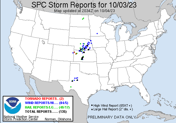
Our Storm Reports
Welcome to the Storm Report History section, where we delve into the annals of weather history to explore the most impactful and memorable storms of the past.
Join us as we journey through the pages of time to uncover the fascinating stories of nature’s most formidable tempests.
| Tornado Reports (CSV) (Raw Tornado CSV)(?) | |||||||
|---|---|---|---|---|---|---|---|
| Time | Location | County | State | Lat | Lon | Comments | |
| 1917 | 5 NNE Ruleton | Sherman | KS | 3941 | 10186 | [Landspout] Ag camera facing west of Goodland show circulation that could have been a landspout. (GLD) | |
| 1941 | 6 SSW Winona | Logan | KS | 3899 | 10130 | Possible brief tornado reported by a storm chaser. (GLD) | |
| Hail Reports (CSV) (Raw Hail CSV)(?) | |||||||
|---|---|---|---|---|---|---|---|
| Time | Size | Location | County | State | Lat | Lon | Comments |
| 1923 | 125 | 6 WNW Russell Springs | Logan | KS | 3895 | 10127 | Delayed social media report of dime to half dollar size with the largest hail at the beginning of the storm and lasting only a minute. Time estimated from radar. (GLD) |
| 2000 | 175 | 2 WSW Monument | Logan | KS | 3909 | 10104 | Public report of hail with a few up to the size of golf balls … mostly smaller around quarter size. Time estimated from radar. (GLD) |
| 2000 | 100 | Anselmo | Custer | NE | 4162 | 9986 | (LBF) |
| 2006 | 125 | 1 NE Monument | Logan | KS | 3911 | 10098 | Emergency manager reports hail up to half dollar in size though only a few of the larger stones. Some blowing dust and heavy rain is also occurring. (GLD) |
| 2013 | 100 | 3 ENE Monument | Logan | KS | 3911 | 10094 | COOP Observer reports hail up to quarters in size. Most hail was smaller in size. (GLD) |
| 2015 | 100 | 8 SSW Elwood | Gosper | NE | 4048 | 9990 | Hail lasted about 20 mins. Time estimated from radar. (GID) |
| 2024 | 200 | Norton | Norton | KS | 3984 | 9989 | Storm Spotter reported one to one and a half inches initially with two inch hail by 3:32 pm CDT. (GLD) |
| 2030 | 100 | 5 N Arapahoe | Gosper | NE | 4038 | 9990 | Video on social media of quarter size hail and 50 mph winds north of Arapahoe. (GID) |
| 2103 | 175 | 1 NNW Phillipsburg | Phillips | KS | 3977 | 9933 | Emergency manager reports golf ball size hail on the north edge of Phillipsburg. (GID) |
| 2107 | 100 | 3 NE Caruso | Sherman | KS | 3937 | 10178 | hail ranged from pea to quarter in size. (GLD) |
| 2119 | 175 | Alma | Harlan | NE | 4010 | 9937 | Photo on social media of golf ball size hail. (GID) |
| 2124 | 300 | 4 SW Norton | Norton | KS | 3980 | 9995 | Follow up report to previous report at the reservoir. One hailstone was found and measured to be three inches. (GLD) |
| 2124 | 200 | Norton | Norton | KS | 3984 | 9989 | Corrects previous hail report from Norton. Storm Spotter reported one to one and a half inches initially with two inch hail by 4:32 pm CDT. (GLD) |
| 2125 | 125 | 3 S Calvert | Norton | KS | 3979 | 9976 | Trained Storm Spotter reports hail mostly pea to dime size with largest up to 1.25 inch. Time estimated. (GLD) |
| 2125 | 200 | Norton | Norton | KS | 3983 | 9990 | Caller reported two inch hail on the west side of Norton. (GLD) |
| 2129 | 200 | 4 SW Norton | Norton | KS | 3980 | 9994 | Relayed report with picture of hail up to two inches in diameter at the Keith Sebelius Reservoir. (GLD) |
| 2134 | 100 | Funk | Phelps | NE | 4047 | 9926 | Delayed report. Report from mPING: Quarter (1.00 in.). (GID) |
| 2140 | 175 | 4 N Funk | Phelps | NE | 4053 | 9926 | (GID) |
| 2153 | 100 | 4 ESE Macon | Franklin | NE | 4017 | 9888 | Report on social media of quarter size hail east of Macon. Time estimated from Radar. (GID) |
| 2155 | 100 | 2 NW Rockville | Sherman | NE | 4114 | 9886 | NERain observer commented hail up to quarter size. (GID) |
| 2215 | 100 | 6 WNW Greeley | Greeley | NE | 4158 | 9864 | NERain observer commented about hail up to quarter size. Time estimated from radar. (GID) |
| 2225 | 175 | 38 SE Fort Stockton | Pecos | TX | 3050 | 10243 | CO-OP observer (38SE Fort Stockton) reports golf ball sized hail from yesterday’s storms. Time of hail estimated by radar. (MAF) |
| 2228 | 100 | Mullinville | Kiowa | KS | 3759 | 9948 | Quarter sized hail reported. (DDC) |
| 2229 | 175 | 1 W Midland | Midland | TX | 3200 | 10210 | Multiple public reports of golf ball sized hail in central Midland between Garfield and A street. (MAF) |
| 2230 | 175 | Midland | Midland | TX | 3200 | 10208 | Report from mPING: Golf Ball (1.75 in.). (MAF) |
| 2233 | 200 | 4 NNE Midland | Midland | TX | 3205 | 10205 | Public photo of 2 inch hail estimated by quarter comparison. (MAF) |
| 2233 | 175 | Mullinville | Kiowa | KS | 3759 | 9947 | (DDC) |
| 2233 | 175 | Ayr | Adams | NE | 4044 | 9844 | (GID) |
| 2234 | 175 | 2 SSE Mullinville | Kiowa | KS | 3756 | 9946 | (DDC) |
| 2235 | 175 | 6 N Midland | Midland | TX | 3208 | 10207 | Report from mPING: Golf Ball (1.75 in.) … Time estimated from radar. (MAF) |
| 2240 | 150 | 9 NNE Mullinville | Kiowa | KS | 3770 | 9941 | (DDC) |
| 2245 | 200 | 6 SSW Centerview | Edwards | KS | 3774 | 9932 | Storm chaser noted via live stream along highway 183 near the kiowa edwards county line. (DDC) |
| 2255 | 250 | Lewis | Edwards | KS | 3794 | 9925 | The emergency manager reported that up to 70 percent of homes in Lewis sustained broken windows and/or storm damaged siding due to wind driven hail. South side of structures (DDC) |
| 2258 | 250 | 1 S Centerview | Edwards | KS | 3780 | 9927 | (DDC) |
| 2259 | 150 | 1 S Centerview | Edwards | KS | 3780 | 9927 | (DDC) |
| 2300 | 250 | 5 SE Garfield | Pawnee | KS | 3803 | 9918 | Report was received via social media with picture. (DDC) |
| 2301 | 175 | 2 E Gail | Borden | TX | 3277 | 10142 | Quarter to golf ball size hail east of Gail on Highway 180. (MAF) |
| 2303 | 275 | Lewis | Edwards | KS | 3794 | 9925 | (DDC) |
| 2310 | 100 | Greensburg | Kiowa | KS | 3761 | 9929 | (DDC) |
| 2310 | 275 | 3 S Garfield | Pawnee | KS | 3804 | 9925 | (DDC) |
| 2317 | 275 | Larned | Pawnee | KS | 3818 | 9910 | Report from mPING: Baseball (2.75 in.). (DDC) |
| 2318 | 250 | Larned | Pawnee | KS | 3819 | 9910 | (DDC) |
| 2324 | 300 | Pawnee Rock | Barton | KS | 3827 | 9898 | 2.5-3 inch hail caused extensive damage to vehicles and pontoon boat. (ICT) |
| 2325 | 250 | 4 NE Larned | Pawnee | KS | 3822 | 9905 | Report from mPING: Tennis Ball (2.50 in.). (DDC) |
| 2330 | 175 | 3 WNW Great Bend Airpor | Barton | KS | 3836 | 9890 | 1.5 to 1.75 hail. (ICT) |
| 0015 | 150 | 4 SW Oberon | Benson | ND | 4788 | 9927 | (FGF) |
| 0015 | 125 | Oberon | Benson | ND | 4792 | 9921 | Relayed from public via broadcast media. (FGF) |
| 0049 | 200 | 1 SSE Champion | Nolan | TX | 3234 | 10062 | (SJT) |
| 0050 | 100 | Devils Lake | Ramsey | ND | 4811 | 9886 | Reported downtown Devils Lake. (FGF) |
| Wind Reports (CSV) (Raw Wind CSV)(?) | |||||||
|---|---|---|---|---|---|---|---|
| Time | Speed | Location | County | State | Lat | Lon | Comments |
| 2028 | 61 | 5 S Burlington | Kit Carson | CO | 3923 | 10228 | ASOS station KITR Burlington Co Airport. (GLD) |
| 2051 | 58 | 3 WSW Speed | Phillips | KS | 3967 | 9947 | Mesonet report of 58 mph winds. (GID) |
| 2100 | 60 | Clayton | Norton | KS | 3974 | 10018 | Trained Storm Spotter estimates storm winds 40-60 mph. (GLD) |
| 2114 | UNK | Norcatur | Decatur | KS | 3984 | 10018 | Social media report with pictures of healthy tree uprooted. (GLD) |
| 2114 | 65 | Norcatur | Decatur | KS | 3984 | 10019 | Site KKSNORCA2 reports 65 mph wind gust. (GLD) |
| 2124 | 65 | Norton | Norton | KS | 3984 | 9989 | Trained Storm Spotter estimated 65 mph gusts with storm. (GLD) |
| 2128 | UNK | 9 SSE Hendley | Furnas | NE | 4002 | 9989 | Facebook photo of a bent road sign along HWY 283 just north of the state line. Time estimated from storm radar. (GID) |
| 2130 | 59 | 2 NNE Huntley | Harlan | NE | 4023 | 9928 | Mesonet reports a 59 mph wind gust. (GID) |
| 2134 | UNK | 2 WNW Pleasanton | Buffalo | NE | 4098 | 9911 | Emergency management reported crop storm damage in the area … at least one pivot downed … and storm damage to large trees at a nearby farm. Time estimated from radar. (GID) |
| 2135 | 67 | 4 SSE Beaver City | Furnas | NE | 4009 | 9981 | Mesonet reports a gust of 67 mph. (GID) |
| 2135 | UNK | 2 ESE Beaver City | Furnas | NE | 4013 | 9979 | Photo and video of a hay barn losing some of its metal roof panels. Report of unknown number of storm damaged power poles just to the east of this location. Time estimated fr (GID) |
| 2135 | 60 | 1 SSE Wilcox | Franklin | NE | 4035 | 9916 | (GID) |
| 2138 | UNK | 2 E Beaver City | Furnas | NE | 4013 | 9978 | tin roof blown off shed and deposited around 25 yards away. (GID) |
| 2138 | UNK | Hollinger | Furnas | NE | 4015 | 9971 | Social media report and photos of some storm damage in Hollinger … including a small metal shed destroyed. Time estimated from radar and nearby reports. (GID) |
| 2155 | 73 | 5 SSW Atlanta | Harlan | NE | 4030 | 9950 | (GID) |
| 2157 | 70 | Rockville | Sherman | NE | 4112 | 9883 | Estimate from the south side of town. Time estimated from radar. (GID) |
| 2222 | 76 | 5 SSE Roseland | Adams | NE | 4040 | 9853 | Via personal weather station. (GID) |
| 2224 | UNK | 5 SSW Midland | Midland | TX | 3193 | 10211 | Public photo of at least 3 downed power poles from straight-line winds. (MAF) |
| 2226 | 62 | 5 NW Natoma | Rooks | KS | 3925 | 9909 | Mesonet reports a 62 mph storm gust. (GID) |
| 2228 | 59 | 8 NNE Codell | Rooks | KS | 3931 | 9912 | Mesonet reports a 59 mph gust. (GID) |
| 2229 | UNK | Midland | Midland | TX | 3200 | 10208 | Tree snapped at intersection of A Street and Cuthbert Ave. Time estimated from radar. (MAF) |
| 2233 | UNK | Ord | Valley | NE | 4160 | 9893 | Minor tree damage in town including a few downed trees. Nearby ASOS clocked a gust of 62 MPH. (GID) |
| 2233 | 62 | Ord Airport | Valley | NE | 4162 | 9895 | ASOS reports a wind gust of 62 mph. (GID) |
| 2235 | 63 | 3 NNW Midland | Midland | TX | 3203 | 10210 | AWOS station KMDD Midland Airpark. (MAF) |
| 2235 | 61 | 3 NW South Haven | Howard | TX | 3222 | 10152 | AWOS station KBPG Big Spring. (MAF) |
| 2236 | 58 | 1 NW Midland Internatio | Midland | TX | 3195 | 10220 | ASOS station KMAF Midland. (MAF) |
| 2239 | 60 | 2 NNE Pauline | Adams | NE | 4044 | 9834 | relayed by EM. (GID) |
| 2241 | 60 | 3 S Gibbon | Buffalo | NE | 4071 | 9884 | Two trained Storm Spotters in area estimating wind gusts around 60 MPH. (GID) |
| 2243 | UNK | 1 S Glenvil | Clay | NE | 4049 | 9825 | Downed power lines in Glenvil and pivot flipped just south of town. (GID) |
| 2245 | UNK | 2 NW Midland | Midland | TX | 3202 | 10210 | Report from mPING: 1-inch tree limbs broken; Shingles blown off. (MAF) |
| 2245 | 60 | Glenvil | Clay | NE | 4050 | 9825 | (GID) |
| 2249 | 65 | 8 SW Osborne | Osborne | KS | 3937 | 9881 | Mesonet reports a gust to 65 mph. (GID) |
| 2251 | 60 | Bladen | Webster | NE | 4032 | 9860 | Relayed via NWSchat. (GID) |
| 2254 | 73 | 2 ESE Gail | Borden | TX | 3276 | 10141 | Mesonet station 26 Gail 2SE. (MAF) |
| 2258 | 80 | 1 NNW Osborne | Osborne | KS | 3945 | 9870 | Mesonet reports a gust to 80 mph. (GID) |
| 2258 | UNK | 1 NNW Osborne | Osborne | KS | 3945 | 9870 | Emergency management reported at least 8 power poles were storm damaged in the area. Tree damage in Osborne. A building was storm damaged in unincorporated Bloomington … which is (GID) |
| 2300 | 60 | 2 N Pauline | Adams | NE | 4045 | 9834 | (GID) |
| 2304 | 62 | 4 SW Hastings | Adams | NE | 4055 | 9844 | Mesonet reports a gust to 62 mph. (GID) |
| 2308 | 60 | Hastings NWS Office | Adams | NE | 4065 | 9838 | Estimated 55 to 60 MPH wind gusts along leading edge. (GID) |
| 2309 | UNK | 1 E Hastings | Adams | NE | 4059 | 9837 | Facebook photo of a large tree limb downed by Hastings College. (GID) |
| 2309 | UNK | Hastings | Adams | NE | 4059 | 9839 | Delayed report. Storm report from mPING: 1-inch tree limbs broken; Shingles blown off. (GID) |
| 2310 | UNK | 1 E Hastings | Adams | NE | 4059 | 9837 | Tree down blocking 7th st. Time estimated from radar and other nearby storm reports. (GID) |
| 2314 | 59 | 9 NW Burr Oak | Jewell | KS | 3995 | 9842 | Mesonet reports a gust to 59 mph. (GID) |
| 2318 | UNK | Larned | Pawnee | KS | 3818 | 9910 | A tree was reported down in Larned due to storm winds. (DDC) |
| 2321 | UNK | 4 W Edgar | Clay | NE | 4037 | 9805 | storm report from mPING: 1-inch tree limbs broken; Shingles blown off. (GID) |
| 2322 | 65 | 1 S Giltner | Hamilton | NE | 4076 | 9815 | per Giltner fire chief. (GID) |
| 2328 | 60 | 6 ESE Clay Center | Clay | NE | 4050 | 9794 | CO-OP observer reports a gust to 60 mph. (GID) |
| 2328 | 62 | 2 W Aurora | Hamilton | NE | 4087 | 9805 | Mesonet reports a gust to 62 mph. (GID) |
| 2329 | 63 | 5 NW Stockham | Hamilton | NE | 4078 | 9800 | (GID) |
| 2330 | UNK | Aurora | Hamilton | NE | 4087 | 9800 | Large tree partially uprooted in Aurora per picture from EM. Time estimated from radar and nearby reports. (GID) |
| 2335 | 62 | Aurora Airport | Hamilton | NE | 4089 | 9799 | AWOS reports a gust to 62 mph. (GID) |
| 2340 | 61 | 3 W Hordville | Hamilton | NE | 4107 | 9795 | Mesonet reports a gust to 61 mph. (GID) |
| 2349 | 65 | 3 W York | York | NE | 4088 | 9766 | via Davis Weatherlink. (GID) |
| 2350 | 60 | 3 SSE Osceola | Polk | NE | 4113 | 9753 | via personal weather station. (GID) |
| 2350 | 86 | 1 S Osceola | Polk | NE | 4117 | 9755 | Edit to previous tstm wnd dmg report from 1 S Osceola. Photos of tree damage on the south side of town and power is out. Davis station anemometer mounted approximately (GID) |
| 2350 | UNK | 1 S Osceola | Polk | NE | 4117 | 9755 | Photos of tree damage on the south side of town and power is out. Davis station anemometer mounted approximately 30 ft up measured a gust of 80 MPH. (GID) |
| 2351 | 65 | 7 E Clarks | Polk | NE | 4122 | 9771 | personal weather station. (GID) |
| 2355 | UNK | 1 E York | York | NE | 4087 | 9758 | Photos on social media of a tree down in York. (GID) |
| 2359 | UNK | 2 ENE Union | Scurry | TX | 3274 | 10096 | 11 power poles reported down between CR242 and CR264 along FM1611. Time estimated from radar. (MAF) |
| 2359 | 60 | Shelby | Polk | NE | 4120 | 9742 | Time est. from radar. (GID) |
| 0003 | UNK | 5 NE Union | Scurry | TX | 3278 | 10094 | 9 power poles down at Hwy 84 and CR 258. Time estimated from radar. (MAF) |
| 0012 | UNK | Columbus | Platte | NE | 4143 | 9736 | Many large limbs down around Columbus. At least one tree uprooted. Window blown out of community center. (OAX) |
| 0012 | 68 | 5 NNW Columbus | Platte | NE | 4149 | 9740 | Recorded at personal weather station. (OAX) |
| 0013 | 73 | 3 WSW Richland | Platte | NE | 4142 | 9728 | Recorded at personal weather station. (OAX) |
| 0014 | UNK | 1 E Columbus | Platte | NE | 4143 | 9733 | Large tree limb blew down on to a camper … trapping an individual inside. No injuries reported. (OAX) |
| 0016 | UNK | 3 S Creston | Platte | NE | 4166 | 9736 | Top of tree broken off. Time estimated by radar. (OAX) |
| 0020 | UNK | 2 SE Surprise | Butler | NE | 4109 | 9729 | Roof ripped from shed. Time estimated from radar. (OAX) |
| 0020 | UNK | 1 SE Surprise | Butler | NE | 4110 | 9730 | Center pivot flipped. Time estimated from radar. (OAX) |
| 0024 | UNK | 2 S Schuyler | Colfax | NE | 4142 | 9706 | Tree down over Highway 15. Time estimated from radar. (OAX) |
| 0040 | UNK | 4 WNW Pilger | Stanton | NE | 4203 | 9712 | Tree down across road. (OAX) |
| 0054 | 70 | West Point | Cuming | NE | 4184 | 9671 | Winds estimated 65-70 mph. Deputy reported the wind moved the car. (OAX) |
| 0057 | 59 | 5 W Rotan | Fisher | TX | 3285 | 10055 | (SJT) |
| 0059 | 67 | 5 E Champion | Nolan | TX | 3235 | 10053 | (SJT) |
| 0110 | UNK | Fairbury | Jefferson | NE | 4014 | 9718 | Law enforcement reports widespread trees across roads in Fairbury. Time estimated from radar. (OAX) |
| 0110 | 82 | Fairbury | Jefferson | NE | 4015 | 9718 | Measured by EM. (OAX) |
| 0116 | 61 | 2 ESE Tekamah | Burt | NE | 4177 | 9618 | TQE ASOS. (OAX) |
| 0125 | UNK | 3 SE Sioux City | Woodbury | IA | 4247 | 9636 | A tree fell on top of a car. Time estimated from radar. (FSD) |
| 0129 | UNK | Sergeant Bluff | Woodbury | IA | 4240 | 9636 | A tree was reported down in Sergeant Bluff. Time estimated from radar. (FSD) |
| 0134 | UNK | 2 N Beatrice | Gage | NE | 4029 | 9675 | Tree limbs broken. (OAX) |
| 0138 | UNK | 1 NW Hickman | Lancaster | NE | 4063 | 9664 | Tree limbs broken. (OAX) |
| 0249 | 64 | 2 W Wellsford | Kiowa | KS | 3762 | 9906 | Mesonet station UP430 1.8 W Wellsford (UPR). (DDC) |
| 0415 | UNK | 1 ESE Mankato | Blue Earth | MN | 4416 | 9397 | 4-5 inch diameter tree branches down near the intersection of Victory and Main Street. Time estimated via radar. (MPX) |